
> From the WeatherWatch archives
A mix of sun and cloud, cloud may be thicker this morning with the chance of a light shower for eastern coastal areas. Northland has slightly more cloud with the odd light shower possible for much of the day, especially in the east. East to northeasterly breezes.
Highs: 18-20
Western North Island (including Central North Island)
A mix of sun and cloud, may be an isolated shower late afternoon / evening for inland areas otherwise mainly dry. Light winds and afternoon sea breezes.
Highs: 18-22
Eastern North Island
Mostly sunny after any morning cloud breaks away, northeasterly winds.
Highs: 19-22
Wellington
Mostly sunny with northerly winds.
High: 19
Marlborough & Nelson
Sunny or mostly sunny with north to northwesterly winds.
Highs: 19-23
Canterbury
Mostly sunny, for inland areas isolated showers develop late afternoon / evening. Some may become heavy about inland Mid and South Canterbury with thunderstorms then clearing later on. East to northeasterly winds.
Highs: 20-23
West Coast
Mostly sunny, some cloud about Buller with the low risk of an isolated shower late afternoon / evening. Light northerly quarter winds.
Highs: 17-22
Southland & Otago
Mostly sunny, chance of an isolated shower late afternoon / evening for inland areas, some may become heavy with thunderstorms then clearing later on. Light winds, afternoon sea breezes.
Highs: 20-26
By Weather Analyst Aaron Wilkinson – WeatherWatch.co.nz
Comments
Before you add a new comment, take note this story was published on 31 Oct 2017.
Latest Video
NZ weather forecast to May 1st
Heavy rain moves north of Auckland city today but remains in the north of the region and should be clearing…
Related Articles
NZ weather forecast to May 1st
Heavy rain moves north of Auckland city today but remains in the north of the region and should be clearing…
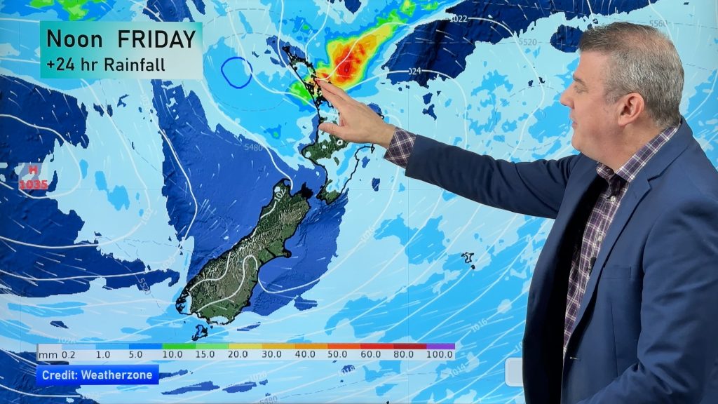
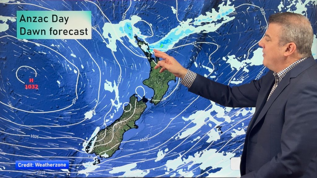
NZ: Anzac Day + long weekend weather, and how next week is shaping up
High pressure is trying to move in to NZ, but there is still the chance of some heavy rain in…
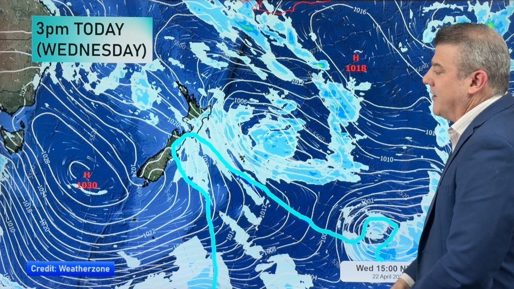
Colder air for Wed/Thu + your Anzac Day & long weekend weather
Rain, showers, some snow then possible frosts are in the forecast for the next 24 hours as the low that…


Add new comment