
> From the WeatherWatch archives
Northland and Auckland see a few mornings showers especially in the west then cloud breaks to sunny spells with southwesterly winds. A mix of sun and cloud for the Waikato and Bay Of Plenty, may be a shower late afternoon / evening. Light southerlies.
Highs: 18-19
Western North Island (including Central North Island)
Nearer the ranges to the east (Manawatu for e.g.) expect cloudy areas with the risk of a shower, further west about the likes of Taranaki expect conditions to become mostly sunny in the morning. South to southeasterly winds.
Highs: 12-17
Eastern North Island
Cloudy with a few patchy light showers, fresh south to southwesterly winds.
Highs: 13-14
Wellington
Mostly cloudy, may be a shower or two with cool southerly winds.
High: 13
Marlborough & Nelson
May be a morning shower, cloud breaking to sunny areas from afternoon about Marlborough with southeasterly winds. Nelson sees cloud hang around for much of the day with light Northerlies from midday.
Highs: 14-16
Canterbury
A few light morning showers, cloud breaks to some sun from afternoon. South to southwesterly winds die out in the evening.
Highs: 10-12
West Coast
Sunny with light winds, inland Buller may see warm afternoon temperatures.
Highs: 17-19
Southland & Otago
May be a morning shower for coastal areas then sunny spells increase, mainly sunny inland after morning cloud breaks away. West to southwesterly winds die out in the evening.
Highs: 14-19
Comments
Before you add a new comment, take note this story was published on 17 Oct 2017.
Latest Video
NZ weather forecast to May 1st
Heavy rain moves north of Auckland city today but remains in the north of the region and should be clearing…
Related Articles
NZ weather forecast to May 1st
Heavy rain moves north of Auckland city today but remains in the north of the region and should be clearing…
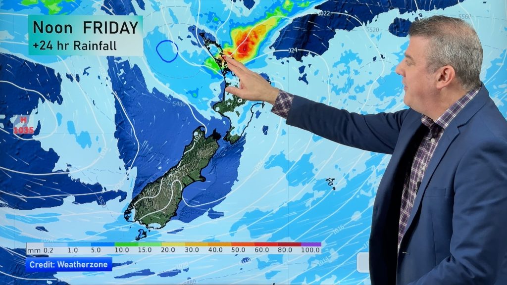
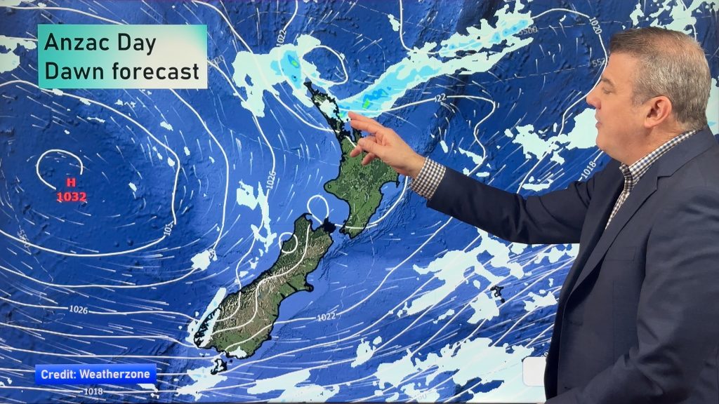
NZ: Anzac Day + long weekend weather, and how next week is shaping up
High pressure is trying to move in to NZ, but there is still the chance of some heavy rain in…
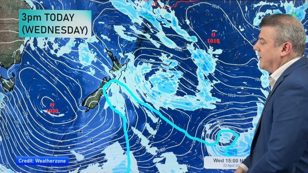
Colder air for Wed/Thu + your Anzac Day & long weekend weather
Rain, showers, some snow then possible frosts are in the forecast for the next 24 hours as the low that…


Add new comment