
> From the WeatherWatch archives
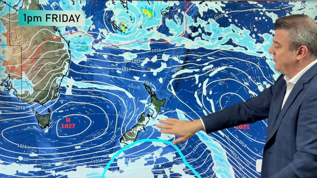
A low in the Tasman Sea moves closer towards the west of the South Island during the day, meanwhile a front moves over the South Island today then pushing onto the North Island overnight.
Northland, Auckland, Waikato & Bay Of Plenty
Sunny areas and increasing cloud, showers from late afternoon or evening then overnight rain. Northerly winds.
Highs: 21-25
Western North Island (including Central North Island)
Mostly cloudy with the odd spit moving in during the evening then some overnight rain. North to northwesterly winds. Some sun about Wanganui southwards at times leading to warm afternoon temperatures before cloud thickens and lowers from late afternoon.
Highs: 19-24
Eastern North Island
Sunny areas and thickening high cloud, a few spots of rain from later in the evening. North to northwesterly winds.
Highs: 27-29
Wellington
Cloudy with a few showers later in the evening then overnight rain. Strong north to northwesterly winds.
High: 18
Marlborough & Nelson
Cloudy, a few spits of rain about Nelson from afternoon then Marlborough later in the evening. Heavier rain moves in overnight. Brisk north to northwesterly winds.
Highs: 18-21
Canterbury
Thick high cloud, odd spot of rain from afternoon with northerly quarter winds. Rain more widespread at night as southwesterly winds freshen.
High: 21
West Coast
Rain with heavy falls about South Westland spreading northwards in the afternoon, rain clears overnight as gusty northeasterly winds change southeast.
High: 17
Southland & Otago
Rain, easing to showers around midday about Southland and in the evening for Otago. Light easterlies tend southerly in the afternoon
Highs: 14-20
By Weather Analyst Aaron Wilkinson – WeatherWatch.co.nz
Comments
Before you add a new comment, take note this story was published on 6 Dec 2016.
Latest Video
22/02/2026 10:53pm
Feb’s last week: High pressure, cold fronts and a tropical low
The weather this week smacks of late February with some settled, warm, dry days in the mix – along with…
Related Articles
22/02/2026 10:53pm
Feb’s last week: High pressure, cold fronts and a tropical low
The weather this week smacks of late February with some settled, warm, dry days in the mix – along with…
18/02/2026 10:51pm
Cold fronts and high pressure – a fairly standard late February forecast
High pressure is increasing around New Zealand this weekend and next week – but it won’t always be centred over…
17/02/2026 11:03pm
7 Day Weather: A few weak cold fronts, but a lot more high pressure
We’re not done with summer – if it does feel a little Autumnal at times now. We have a few…


Add new comment