Warmth returns Sunday to places windy and cooler today (+2 Maps)
5/01/2018 10:45pm

Gales in Wellington, showers around the country and a lot of cloud today will make way for warmer weather on Sunday as our storms exits and high pressure builds.
A ‘spring-like’ pattern continues in the lower half of the South Island over the coming week, with daytime highs fluctuating between cool, mild and hot. For example the high in Alexandra, Central Otago today is only 17C degrees. Near 30C by Tuesday. 20C by Thursday. Back up to 27C next Saturday.
Places like Gisborne may also have similar ‘spring-like’ fluctuations in temperatures due to varying wind directions (cooler southerlies, hotter westerlies) in the next week.
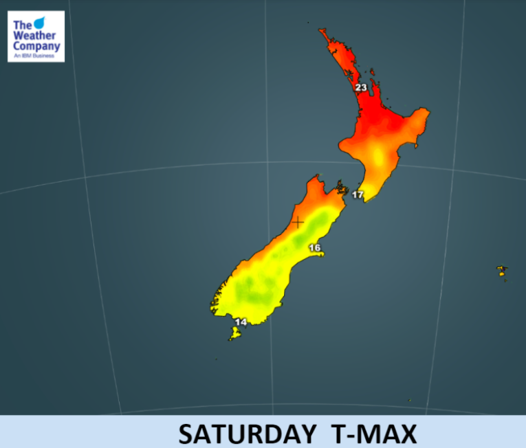
THIS WEEKEND:
For those enduring a windy, cloudy, cooler Saturday as the storm exits to our south east we expect the strong south to south west winds to ease tonight for most areas – with a calmer, warmer, Sunday for most parts of the country.
It may still be a little cloudy for some in the north east of the North Island with a few showers and slightly cooler air flows still fading out.

– WeatherWatch.co.nz
Comments
Latest Video

VIDEO: RainWatch – Will a northern low bring rain next week?
High pressure has been dominating NZ for almost two weeks now but next week there is the chance of some…
Related Articles
VIDEO: RainWatch – Will a northern low bring rain next week?
High pressure has been dominating NZ for almost two weeks now but next week there is the chance of some…

Weekend Newsfeed: High pressure moves in by Monday (+6 Maps)
Colder airflows will fade this weekend but the nights will still be colder due to lighter winds and high pressure…

The solar winter has begun… the 3 darkest months of the year
While we’re still in Autumn the “Solar Winter” has just begun – the second week of May marks the three…


Add new comment