
> From the WeatherWatch archives
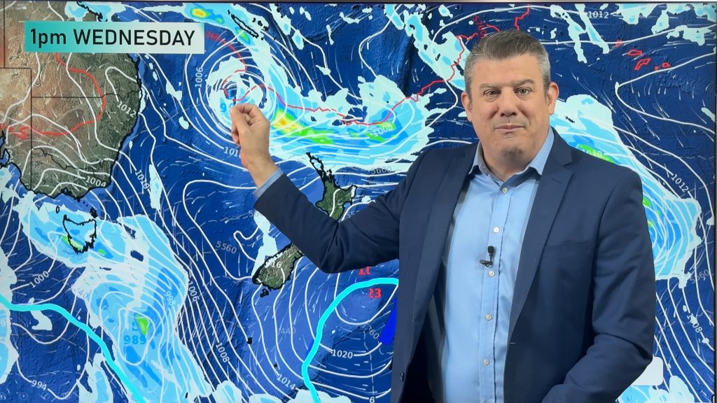
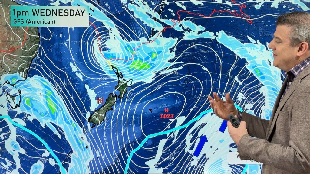
A low pressure system sits out to the west of the North Island today, a front associated with it swings onto the top half of the North Island this evening and overnight bringing some heavy rain and possibly a few thunderstorms. Eastern parts of the country can expect mainly sunny weather with high cloud, southerlies develop from afternoon about the lower South Island however bringing cloud and the odd shower.
Northland
Mostly cloudy with the odd drizzle patch, rain develops late afternoon and may be heavy for a time in the evening with thunderstorms then clearing around midnight. Brisk gusty northeasterlies ease overnight.
Highs: 18-19
Auckland
Mostly cloudy with the odd drizzle patch possible otherwise mainly dry, rain develops later in the evening and may be heavy for a time overnight with thunderstorms then easing before dawn on Wednesday. Brisk gusty northeasterlies.
High: 18
Bay Of Plenty, Waikato & Central North Island
Mostly cloudy with the odd drizzle patch, rain develops later in the evening and may be heavy overnight. Breezy northeasterlies.
Highs: 16-19
Eastern North Island
Mostly sunny with northeaterly winds brisk in the afternoon for coastal areas. Some high cloud develops after midday.
Highs: 20-21
Taranaki
Sunny spells and increasing cloud, becoming mostly cloudy by evening with breezy northeasterly winds. The odd shower possible at times from afternoon then overnight rain develops.
High: 18
Western North Island
Sunny spells and increasing cloud, becoming mostly cloudy by evening with northeasterly winds. The odd shower moves in later in the evening.
High: 21
Wellington
Sunny areas and increasing high cloud, northerly winds. Late afternoon or evening winds change to the south bringing the odd shower.
High: 17
Nelson
Becoming mostly cloudy in the morning with northeasterly breezes, the odd drizzle patch or shower by midday. Winds change southeasterly later in the evening.
Highs: 17-18
Marlborough
Sunny with increasing high cloud, north to northeasterly breezes. There could be a spit of rain at times spreading from the west otherwise mainly dry. Later in the evening winds change southerly with the odd shower developing.
High: 19-21
Canterbury
Sunny with some high cloud and light north to northeasterly winds, late afternoon or evening winds change southerly bringing the odd drizzle patch.
Highs: 19-23
West Coast
Mostly cloudy with patchy rain or drizzle, northeasterly winds. Areas of precipitation clear in the evening as winds tend southeasterly. Skies becoming clear overnight.
High: 17
Coastal Otago
Morning high cloud and sunny areas, light northerlies. Winds change southerly around midday bringing increasing cloud and a few dirzzle patches late afternoon. Drizzle clears at night.
High: 17
Central Otago
Sunny with light winds and some high cloud, late afternoon winds change southerly bringing showers which clear overnight.
Highs: 19-21
Southland
Winds change southerly in the morning bringing cloudy skies and drizzle patches. Drizzle clears at night with cloud breaking up a little towards dawn on Wednesday morning.
High: 15
By Weather Analyst Aaron Wilkinson – WeatherWatch.co.nz
Comments
Before you add a new comment, take note this story was published on 4 Nov 2013.
Latest Video

Temperatures to lift, before dropping again this weekend
Subtropical and north-west winds will help boost temperatures around NZ both by day and night followed a colder couple of…
Related Articles
Temperatures to lift, before dropping again this weekend
Subtropical and north-west winds will help boost temperatures around NZ both by day and night followed a colder couple of…
Subtropical low vs subantarctic energy = typical early Autumn setup
A low pressure zone leaving Queensland tonight may brush the very top of the North Island midway through this week…
Subtropical low next week worth monitoring as high pressure controls all
High pressure smothers NZ today and will weaken a little on Sunday and Monday to allow a cooler southerly flow…


Add new comment