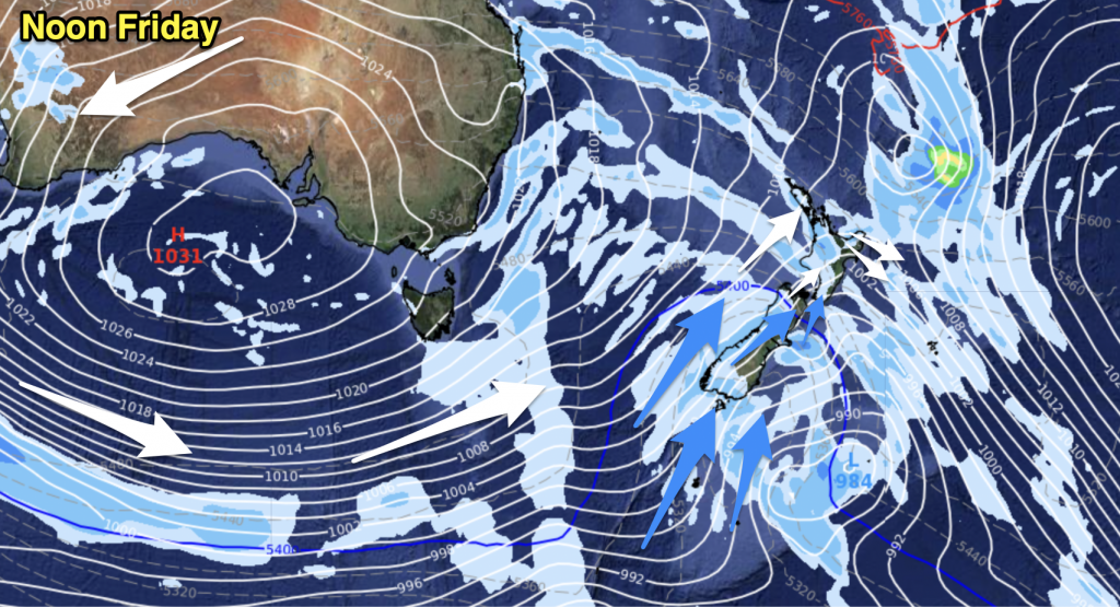
A front moves northwards over the South Island today, with breezy northwesterlies ahead of the front then changing southerly in behind. A west to northwesterly airflow lies over the North Island.
Northland, Auckland, Waikato & Bay Of Plenty
Cloudy areas with the risk of a shower, mainly Auckland southwards. Breezy westerly winds.
Highs: 19-22
Western North Island (including Central North Island)
Mostly cloudy with occasional showers, breezy to brisk westerly winds.
Highs: 17-18
Eastern North Island
Sunny with breezy west to northwesterly winds.
Highs: 24-26
Wellington
Sunny spells with strengthening northwesterly winds, a few showers overnight.
High: 19
Marlborough & Nelson
Sunny areas and increasing high cloud, a few spots of rain possible afternoon / evening otherwise mainly dry. Northwesterlies becoming gusty after midday.
Highs: 20-24
Canterbury
Mostly sunny, breezy northwesterly winds. A late afternoon or evening southerly change brings increasing cloud.
Highs: 24-25
West Coast
Rain, heavy at times then easing to showers in the evening as northwesterlies tend southwest later in the day.
Highs: 16-19
Southland & Otago
A few showers develop about Southland in the morning. Dry at first about Otago then a few showers from afternoon. Brisk to strong westerlies tend southwest during the afternoon.
Highs: 13-20
By Weather Analyst Aaron Wilkinson – WeatherWatch.co.nz


Add new comment