
> From the WeatherWatch archives
A spring blast is affecting New Zealand but eases back a little today in some regions.
NORTH ISLAND:
A cold front quickly crosses the North Island this morning, weakening as it tracks to the north. There will be some spillover in to the east. A few showers linger in the west in the afternoon, becoming mostly dry though. Winds from the westerly quarter, still blustery for some regions.
HIGHS: 14 to 22 (warmest in the east, coolest in the west)
SOUTH ISLAND:
Rain on the West Coast breaking apart with increasing dry spells later. Some spillover into Southland and Otago but mainly dry in the east. A cooler day in the south.
HIGHS: 11 to 20

– WeatherWatch.co.nz
Comments
Before you add a new comment, take note this story was published on 3 Nov 2018.
Latest Video
NZ weather forecast to May 1st
Heavy rain moves north of Auckland city today but remains in the north of the region and should be clearing…
Related Articles
NZ weather forecast to May 1st
Heavy rain moves north of Auckland city today but remains in the north of the region and should be clearing…
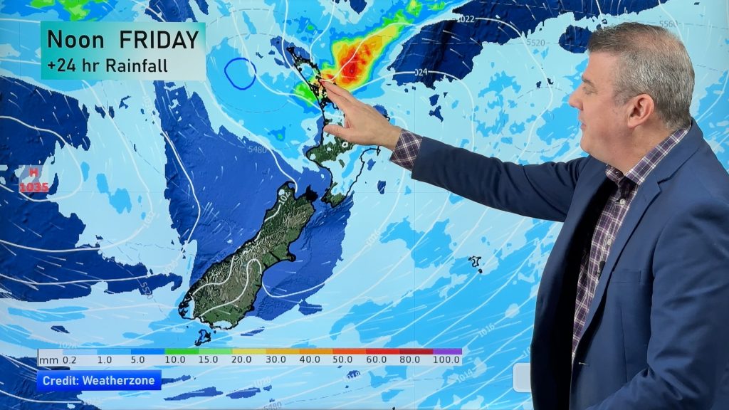
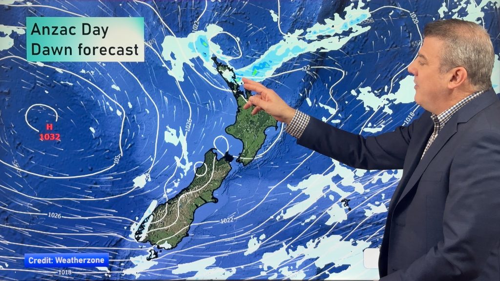
NZ: Anzac Day + long weekend weather, and how next week is shaping up
High pressure is trying to move in to NZ, but there is still the chance of some heavy rain in…
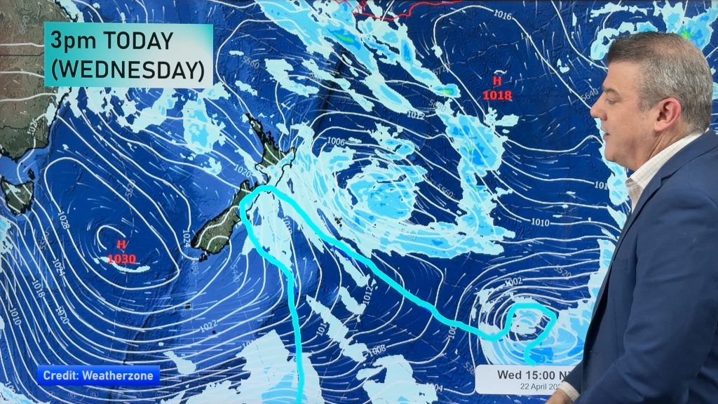
Colder air for Wed/Thu + your Anzac Day & long weekend weather
Rain, showers, some snow then possible frosts are in the forecast for the next 24 hours as the low that…


Add new comment