
> From the WeatherWatch archives
A new survey has reaffirmed the threat of an underwater landslide sending a rapid-fire tsunami towards the Kaikoura coast.
Earlier this year, scientists from the The National Institute of Water and Atmospheric Research (Niwa) returned to the Kaikoura Canyon as part of ongoing work to assess the risk of tsunami from submarine landslides in the event of a large earthquake.
The vast canyon – coming to within 500m of the coast south of Kaikoura and feeding sediment into the 1,500km-long Hikurangi Channel running east of New Zealand – has been flagged as a serious risk in previous studies.
Concerns centred around build-ups of sediment at various points around the rim of the deep canyon, which could potentially trigger tsunamis with a sudden collapse.
“All of those sediments are muddy, potentially weak, and might contain sand bodies that can have pressure within them and could fail during an earthquake,” Niwa ocean geologist Dr Joshu Mountjoy said.
A likely trigger would be the Hope Fault, running just north of Kaikoura and capable of producing a large earthquake.
Landslides at the head of the canyon were thought to happen every 200 years on average, and past modelling had shown a large one could result in a tsunami bearing down on South Bay with a crest 13m above sea level.
Last year, Dr Mountjoy and colleagues used high-tech seismic equipment to map the seabed and collected sediment to see how much was accumulating. His team have just finished the second part of the fieldwork, a geotechnical study, with the ultimate aim of creating a computer model that could be used to test a range of earthquake scenarios.
“We see this as an area that has all the components for a landslide tsunami hazard situation,” Dr Mountjoy said. “We’ve got very shallow water next to the canyon edge; steep slopes of the canyon which drops off down to 1000m; large areas where there might be weak sediment; large earthquake sources nearby; and all of it very close to the highway and populated areas.”
While there were signs of previous landslides around the canyon, constant erosion and the impact of large storms had removed much of the evidence. “The exact volume of the material we’d be looking at during one event is really what we are trying to figure out now.”
Dr Mountjoy will be discussing findings with local residents at public meetings this week.
A new marine reserve announced this week would encompass the Kaikoura Canyon.
Landslide tsunamis
• Triggered when earthquakes displace large volumes of sediment underwater.The resulting landslide sends a surge of water toward the coast.
• An under-recognised natural threat in New Zealand. Have proven deadly in cases around the world.
Kaikoura Canyon
• Vast underwater canyon which comes to within 500m of the coast south of Kaikoura and feeds sediment into the Hikurangi Channel.
• Surveys indicate the canyon is at risk of an underwater landslide in the event of an earthquake.
• Niwa geologists, led by Dr Joshu Mountjoy, have mapped the seabed to help predict what would happen in an earthquake.
– NZ Herald
Comments
Before you add a new comment, take note this story was published on 20 Mar 2014.
Latest Video
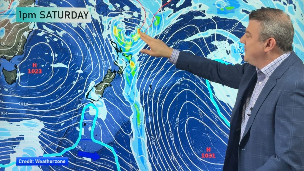
Stormy low may bring severe weather Sunday/Monday to North Island
Low pressure is expected to deepen quickly this weekend near the upper North Island and track just east of the…
Related Articles
Stormy low may bring severe weather Sunday/Monday to North Island
Low pressure is expected to deepen quickly this weekend near the upper North Island and track just east of the…
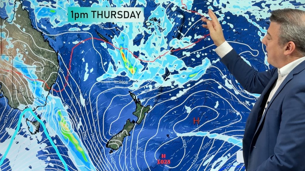
Weekend low “one to monitor” as high pressure slips away for a time
We have a gap in the high pressure belt, starting Friday and possibly lingering until the start of next week….
High pressure likely to be replaced by low pressure this weekend
Many places are dry as we go into this week, although a few showers and afternoon downpours are possible. But…


Add new comment