Snow on the southern ranges but subtropical northerlies for NZ by Sunday (+4 Maps)
5/02/2018 9:47pm

Another dusting of snow on the South Island mountains this morning has left a few people asking if this is Autumn already – the answer is no, but with a but. While summer heat will continue through the next month or two it is probably safe to say that the South Island has probably peaked with summer heat.
The next few days will see a gradual warm up – but long range data suggests we may not be seeing many 30+ days coming up with highs mainly in the mid 20s.
New Zealand is no stranger to a dusting of snow in mid summer. On January 22nd last year a headline at WeatherWatch.co.nz read “When is Summer Coming?” when Mt Taranaki was covered in a fresh dusting of snow. A poll back in January last year revealed 61% were disappointed with summer. A poll currently on the WeatherWatch.co.nz website shows a majority want cooler weather in February while just 13.5% want it to be even hotter.
You were absolutely correct!
Just a dusting overnight Monday. pic.twitter.com/APjXwLGCLT— John Wedlake (@Oletinner) February 5, 2018
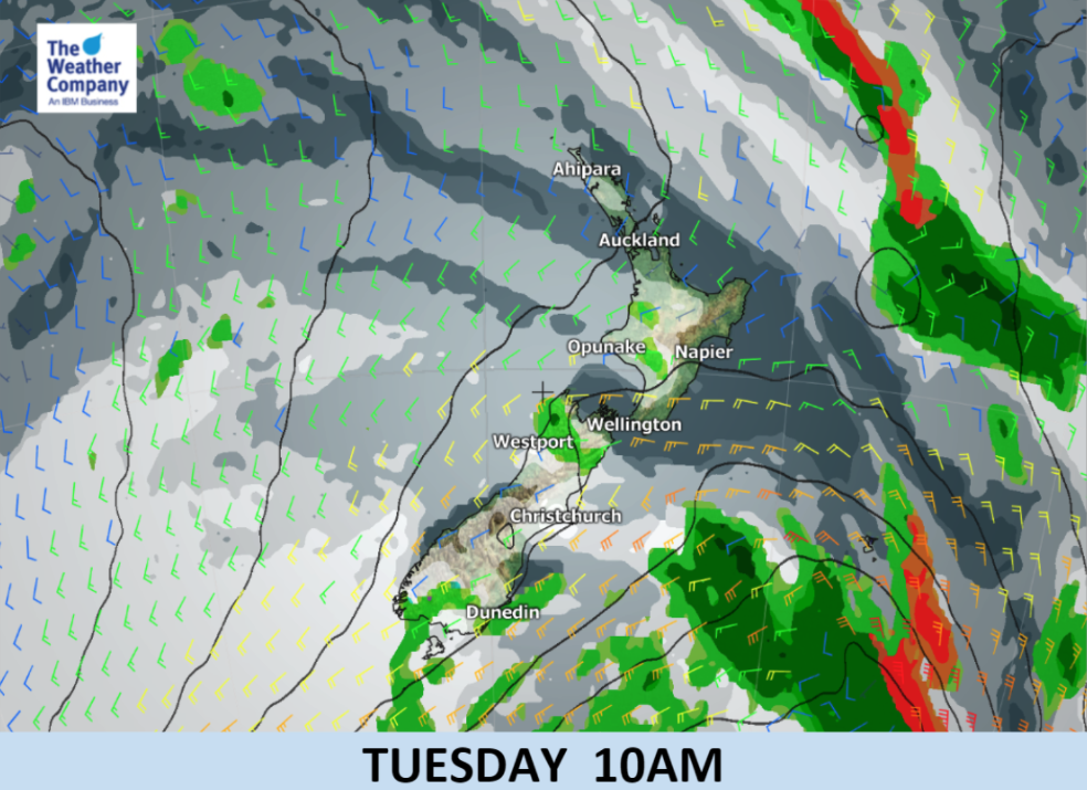
With a high pressure system rolling in this week temperatures will return to normal for South Islanders. Overnight lows will be in the single digits for the next couple of nights but by the end of the week and weekend the humid nor’east flow around New Zealand will see overnight lows in the mid teens and low 20s.
In fact the North Island is about to get very humid again thanks to the sub-tropical flow with overnight temperatures dropping only a few degrees from daytime highs.
An easterly flow in northern New Zealand will kick in this week before the north to north east flow at the weekend. Winds may become quite brisk in exposed areas with rain in Northland heavy at times.
Where’s our summer gone I’m wondering ? Feeling more like spring. @WeatherWatchNZ pic.twitter.com/joQq0Ynvxm
— DonG (@gracedon1) February 5, 2018

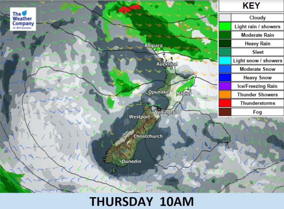
 Areas in orange indicate gales, yellow = brisk.
– WeatherWatch.co.nz (an official IBM business partner)
Comments
Latest Video

Tuesday Newsfeed: Low pressure to cross North Island on Tuesday, rain lingers in east (+9 Maps)
Updated 7:55am Tuesday — Heavy rain continues for parts of the North Island, including dry eastern and southern parts. The…
Related Articles
Tuesday Newsfeed: Low pressure to cross North Island on Tuesday, rain lingers in east (+9 Maps)
Updated 7:55am Tuesday — Heavy rain continues for parts of the North Island, including dry eastern and southern parts. The…

VIDEO: Heavy rain for parts of the North Island Monday/Tuesday as low moves in
Rain is coming into the North Island and brushing some parts of the South Island over the next few days…

Monday Newsfeed: Low pressure descending on North Island this week with areas of rain/showers
Wet weather is back in the forecast for some dry parts of New Zealand, mainly north-eastern parts of the North…


Add new comment