Snow falls in Dunedin, lower South Island, Gales blast other parts of NZ (+6 Photos)
24/07/2016 3:37am

> From the WeatherWatch archives
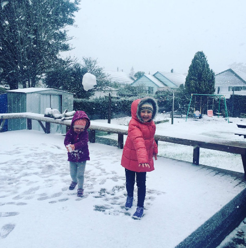
Updated 3:37pm — Snow has been falling to 100m or so around Southland and now snow is falling to a couple of hundred metres in Dunedin as polar air swipes the lower South Island. Photos coming into WeatherWatch.co.nz’s Twitter page show snow heavy enough to make snowballs and putting a layer across roads in higher up suburbs. Reports of sleet to sea level are also coming in.
The air temperature in Dunedin at 3pm was between 0 and 3 degrees and wind chills were as extreme as -6 in some coastal Otago areas as the polar southerly kicked in. “I’ve lived in -30 with windchill of -40. That was fun” tweeted “clouds&life” (@Christodemp).
Snow in parts of Dunedin will ease this afternoon.
The polar air is affecting Southland and Otago today, and some of the mountains further north, but generally the powerful westerly blast over the rest of the nation is stopping this southerly from heading any further north.
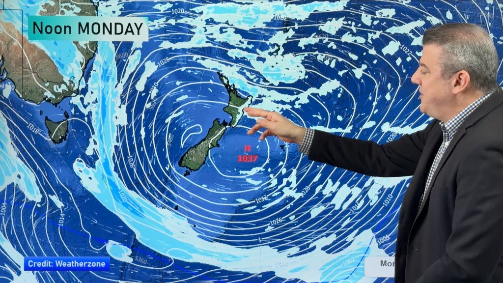
While it’s bitterly cold for some in the south today, tomorrow the airflow changes and by Monday morning much of the air flow across the country will be coming back from Australia again – with the flow connecting Sydney directly to the upper North Island on Monday and milder air from the Melbourne area heading towards the South Island as the day goes on.
WINDY TODAY – 3:30pm update
Westerly quarter winds are continuing to howl across parts of the country with gales spreading as far north as Auckland and hurricane force winds continuing to slam parts of the lower North Island. As of 3:20pm gusts of 134km/h were affecting exposed parts of coastal Wairarapa and Welington has dropped from 100km/h gusts at noon to 60 to 75km/h.
Masterton has had gusts of 115km/h today, it’s 90km/h around many other areas like Manawatu, Horowhenua, coastal Marlborough and up towards Taranaki and over towards Hawkes Bay. For those driving the Napier-Taupo Highway gusts may even exceed 130km/h in the most exposed/vulnerable areas so drivers should take extreme care this afternoon and tonight.
Auckland City is experiencing gusts between 70 and 90km/h, also making driving a bit difficult especially on more busy and exposed highways like the Harbour Bridge or other coastal Motorways.
100km/h gusts are affecting inland parts of the South Island while heavy snow that was earlier pushing into parts of Southland is now brushing Dunedin down to about 200m from what we can tell, and should ease this afternoon.
Auckland’s sudden Temperature drop:
A burst of torrential downpours and gale force winds hit Auckland early this afternoon with temperatures tumbling five degrees in eight minutes, from 17 to 12 degrees. Other private stations recorded even greater drops. However temperatures have bounced back to the mid teens for many in the region, with westerly gales.
Northern areas of New Zealand are not going to be impacted by the polar air, with temperatures in the upper North Island only falling back to average today, or maybe even still remaining above average, following the much warmer than average day yesterday (sorry for all the ‘averages’!).
Snow on a Sunday afternoon. Dunedin hill suburbs 220m @lertinfo @WeatherWatchNZ” – Phil Lemin – @phil_lemin
 Pic Above & Below both by Mike Mackenzie on Twitter: @vebbed
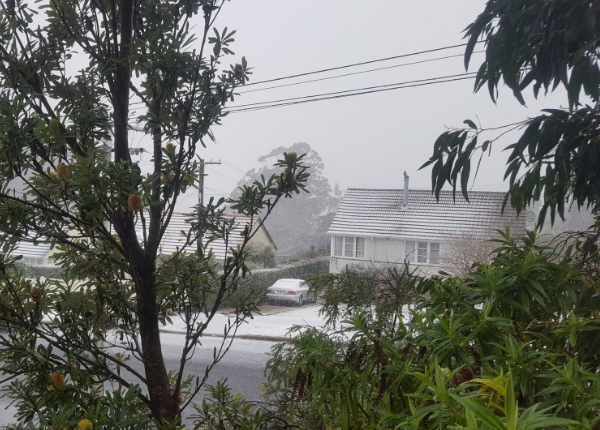

“Pretty cold right now Halfwaybush Dunedin” – Twitter: @TroubleRossnz
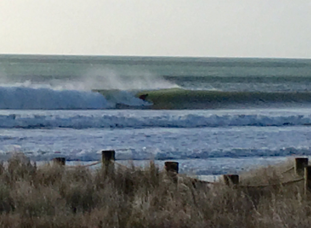
“Wind at #waihibeach not doing the surf much good @WeatherWatchNZ, @SurfRaconteur caught a few though” wrote Ben Haarmann on our Twitter page.

“First Snow of the winter! Heavy snow falling at 150 metres” wrote Blake Newport on our Twitter page a short time ago.
– WeatherWatch.co.nz
Comments
Before you add a new comment, take note this story was published on 24 Jul 2016.
Latest Video
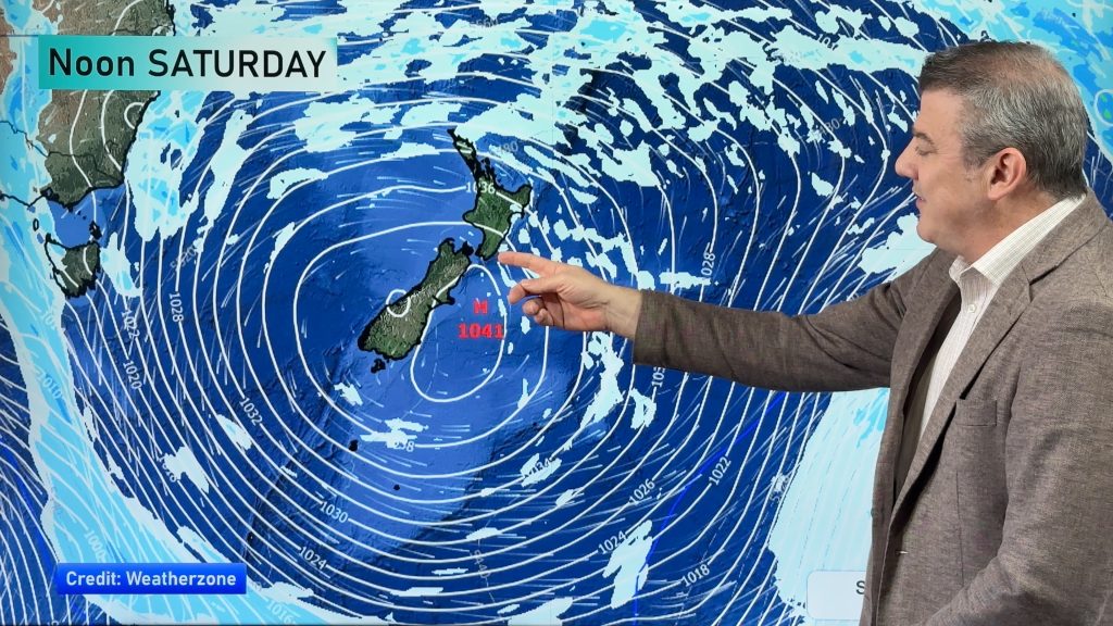
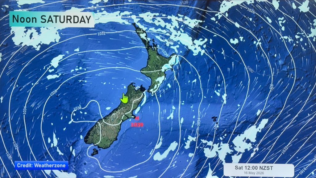
NZ 8 day outlook as high pressure moves through
High pressure will cross the South Island this weekend bringing light winds, cold nights, frosts and fog, while the North…
Related Articles
NZ 8 day outlook as high pressure moves through
High pressure will cross the South Island this weekend bringing light winds, cold nights, frosts and fog, while the North…
Eastern cloud/showers for the NI, high pressure expands elsewhere
A colder south to south-east flow will keep clouds and showers moving into some eastern parts of the North Island…
High pressure growing slowly, eastern showers for NI
A colder airflow is spreading across all of NZ now and will continue on as high pressure slowly moves towards…


Add new comment