
> From the WeatherWatch archives
Severe gales are blasting the Wellington and Wairarapa regions today as a spring storm inches northwards. Sustained winds over 100km/h are affecting Wellington’s hilltop suburbs with gusts to 130km/h and gusts to almost 150km/h at the southern tip of the North Island.
In downtown Wellington gusts are a little lighter reaching 90km/h with sustained winds just under gale force at about 50km/h. (gale force is sustained winds at 62km/h)
The Weather Watch Centre expects little in the way of damage from the winds and says they pose the biggest threat to motorists. “All drivers, not just drivers of vans, motorbikes and camper-vans, but all drivers should take extreme care this afternoon around Wellington and Wairarapa. In some exposed places these winds will be hurricane force which can blow vehicles off roads” says Philip Duncan, head weather analyst at WeatherWatch.co.nz.
Earlier today strong winds around Christchurch blew a truck off the road and downed trees and power lines also affected motorists.
Click here for the latest road conditions.
Mr Duncan says winds will ease tonight but may pick up a little more in the northern half of the North Island.
The strong winds have helped fan higher temperatures in the east today. As independently forecast by the Weather Watch Centre earlier this week temperatures have hit 25 in both Napier and Christchurch and Mr Duncan says some inland areas may be even higher.
What’s it like where you are? Add a comment below!
Comments
Before you add a new comment, take note this story was published on 4 Oct 2008.
Latest Video
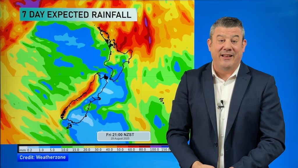
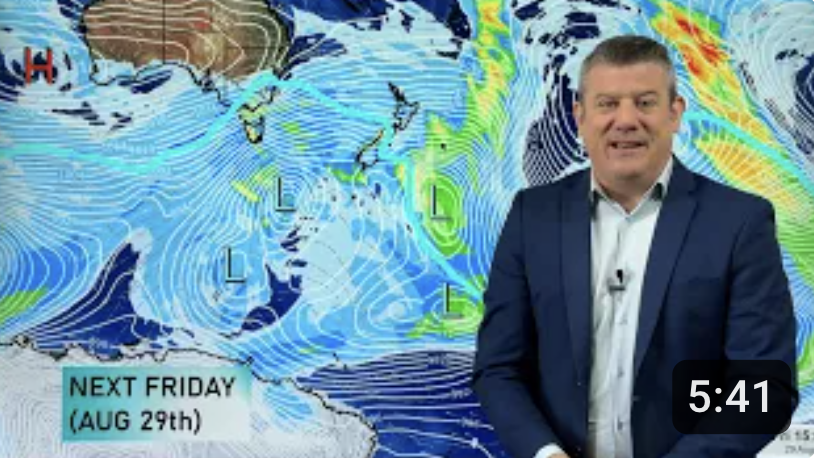
NZ 7 Day: Huge high, followed by even larger low
Powerful high pressure is crossing the South Island today and tomorrow then will lie east of the country going into…
Related Articles
NZ 7 Day: Huge high, followed by even larger low
Powerful high pressure is crossing the South Island today and tomorrow then will lie east of the country going into…
NZ VIDEO: Frosty high incoming, windy westerlies possible in a week
Powerful high pressure is moving in and over the South Island this weekend bringing more frosty nights and cold mornings…
NZ VIDEO: Powerful high pressure arrives, cold nights kick back in
Frosty conditions will affect both main islands going into the later part of this week and the upcoming weekend as…


Add new comment