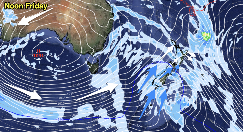
A front lies over Northland / Auckland this morning, it gradually weakens and moves north as the day moves along. The rest of the North Island lies under a southeasterly airflow while the majority of the South Island has a ridge of high pressure. A front pushes onto Southland and Otago later this afternoon / evening then moves northwards overnight.
Northland, Auckland, Waikato & Bay Of Plenty
Morning rain or showers clear for most then expect afternoon sunny areas. Northland may see showers continue through till evening. The Waikato and perhaps Bay Of Plenty may be fairly dry all day long, only the chance of a morning shower. Southeasterly winds.
Highs: 16-17
Western North Island (including Central North Island)
High cloud breaking away to some sun in the afternoon, southeasterly winds.
Highs: 13-15
Eastern North Island
Showers gradually ease then clearing in the evening, showers may continue through the night Gisborne northwards however. Southeasterly winds.
Highs: 14-15
Wellington
Cloud breaks to afternoon sunny spells, southeasterly winds.
High: 13
Marlborough & Nelson
Mostly sunny after some morning cloud breaks away, east to southeasterly winds about Marlborough. Light winds for Nelson.
Highs: 12-14
Canterbury
Morning cloud breaks to mostly sunny weather, light east to northeasterly winds. Overnight showers with a gusty southwest change.
Highs: 11-12
West Coast
A sunny day with light winds, some overnight cloud.
Highs: 13-14
Southland & Otago
Morning cloud breaks to mostly sunny weather, a fresh southwest change late afternoon or evening brings showers.
Highs: 10-13
By Weather Analyst Aaron Wilkinson – WeatherWatch.co.nz


Add new comment