
The sub-tropics, a low and a front are all working to drive in plenty of cloud and humidity this weekend and that means rain for quite a few regions too.
While the rain may only be spits or patches of drizzle and showers for some areas (mainly the east) those in the west could be facing a wetter forecast.
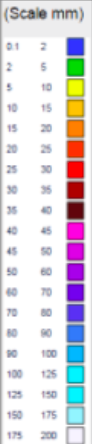
The South Island’s West Coast will be the wettest – over 150mm of rain is possible and this may lead to slips and flooding. It may also prompt rain warnings by tax funded Government forecaster MetService.
In the North Island’s western coastline there will be much greater dry spells – however the rain in the north of New Zealand may linger over Saturday and into early Sunday. It’s a mix of drizzle, dry spells, showers and patchy rain – with rain most likely later in the day on Saturday in places like Auckland.
Southland, a region that has been much warmer and drier than usual lately, has a chance of some soaking rains over the weekend too – but they are less likely to be so soaking in Central Otago, South Canterbury, Hawke’s Bay and Gisborne…the driest parts of the country right now.

– Images / The Weather Company (an official WeatherWatch partner)
– WeatherWatch.co.nz
Comments
Latest Video

VIDEO: High pressure to cross NZ, but a westerly change behind it
Colder air takes us into the weekend but next week milder sub-tropical winds and westerlies are likely as high pressure…
Related Articles
VIDEO: High pressure to cross NZ, but a westerly change behind it
Colder air takes us into the weekend but next week milder sub-tropical winds and westerlies are likely as high pressure…

Thursday Newsfeed: Colder air heads north
A colder southerly flow is spreading up and across NZ today bringing frosty weather to inland parts of both main…

VIDEO: !Frost Alert as high pressure brings colder air, a change possible next week
Massive high pressure near Tasmania is bringing in a colder southerly for NZ today and that means frosts over the…


Add new comment