Northern thunderstorms, Southern winds and another brief cool down (+4 Maps)
3/02/2018 9:05pm

Downpours are dotted across the upper North Island today with some heavier downpours with isolated thunderstorms forecast later today in the Auckland and Northland regions. As of 10am most downpours were around Whangare.
These scattered showers are today moving back into parts of Northland and Auckland and will spread into more parts of the North Island across Monday, possibly with isolated thunderstorms.
There may well be log dry, even sunny periods, after these downpours have passed.
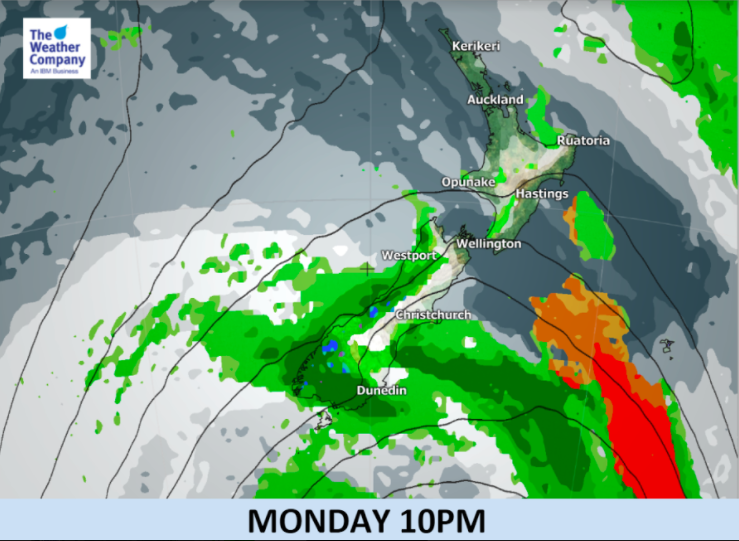
Meanwhile, a surface trough accompanying a weak cold front will be passing through the southernmost part of the South Island. A strong persistent west to southwest wind with some strong gusts are likely in coastal regions in Southland and Otago until Tuesday.
For Westland and Southland several hours of persistent rain will pass through tonight, followed by events of short-duration showers – this is terrific news for farmers struggling in drought with following wet weather after ex-cyclone Fehi’s saturating rains there late last week. Rain accumulation produced by this front system will be not as heavy as warning level.
A warm surge of air today is moving back over Canterbury with this new westerly shift in airflow, but another cool down is coming tonight and into the start of the week for Southland and Otago.


– WeatherWatch.co.nz
Comments
Latest Video

VIDEO: Anzac Day + weather to next Tuesday
Anzac Day looks mild for many parts of NZ with windy nor’westers gusting to gale force for some. Many regions…
Related Articles

Weekend Newsfeed: Friday’s windy, showery, Southerly change – but high pressure from Sunday (+4 Maps)
We’ve got ourselves a good ol’ fashioned Autumn sou’west flow with Friday seeing cooler/colder weather spreading across the country with…

Anzac Day Newsfeed: Severe gales, heavy rain for some, settled for others
Updated 4am — High pressure over northern NZ moves east of the country on Thursday while a storm south of…
VIDEO: Anzac Day + weather to next Tuesday
Anzac Day looks mild for many parts of NZ with windy nor’westers gusting to gale force for some. Many regions…


Add new comment