> From the WeatherWatch archives
As WeatherWatch.co.nz first forecast at the end of February the second week of March looks likely to be impacted by wet weather from the sub-tropics with a rain maker arriving on Tuesday and the low responsible not clearing New Zealand until Tuesday next week.
The week long event doesn’t mean 7 days of non-stop rain, but it does mean the chance for rain will be quite high and the sub-tropical element means some downpours could be set in. Cloudy weather is also more likely and higher humidity.
WeatherWatch.co.nz also believes this rain event will put an end to the drought in Northland and Gisborne areas and certainly will leave the rest of the North Island in a very healthy shape as we head towards winter from a farming point of view. Facial eczema is expected to become more of a problem with the warmth plus humidity though.
There is still some uncertainty about the exact track of this slow moving low, or the exact alignment of rain over the northern part of the country – and how our hills and ranges may impact the rain clouds. But a clearer forecast is now starting to emerge. We’ve tried to make sense of all the chaos below:
THE SITUATION
For those of you who have been watching the long range forecasts and the rain maps you may have noticed a couple of things. The forecasts do sometimes suggest rain will be nonstop for days while the rain maps show big gaps of dry.
Basically the CHANCE for rain is high – but that doesn’t mean it will rain all the time. In fact our hills and ranges can effectively double up the rain in one area while leaving the other side mostly dry. When the low is sizeable like this week the computer models can be a little generic and suggest everyone has a risk of rain. Also, with the low being so large the rain clouds break up. It can create highways of showers – basically lines of downpours which feed in all day to one area, while north or south of that it’s much drier.
The low in the Tasman Sea is stuck and won’t be moving until this coming weekend. That’s when more rain and wind moves in and this time affects both islands, but the low should depart away from New Zealand next Monday PM/Tuesday AM.
THE TIMELINE
Tuesday – The Tasman Sea low gives a helping hand to the incoming South Island southerly. Rain starts to move into the upper North Island starting in Northland and sliding south into Auckland later in the day. At the same time the southerly change will combine with the northern band of rain creating for some pretty heavy downpours around much of the North Island. Most of this rain will be overnight Tues and early Weds morning.
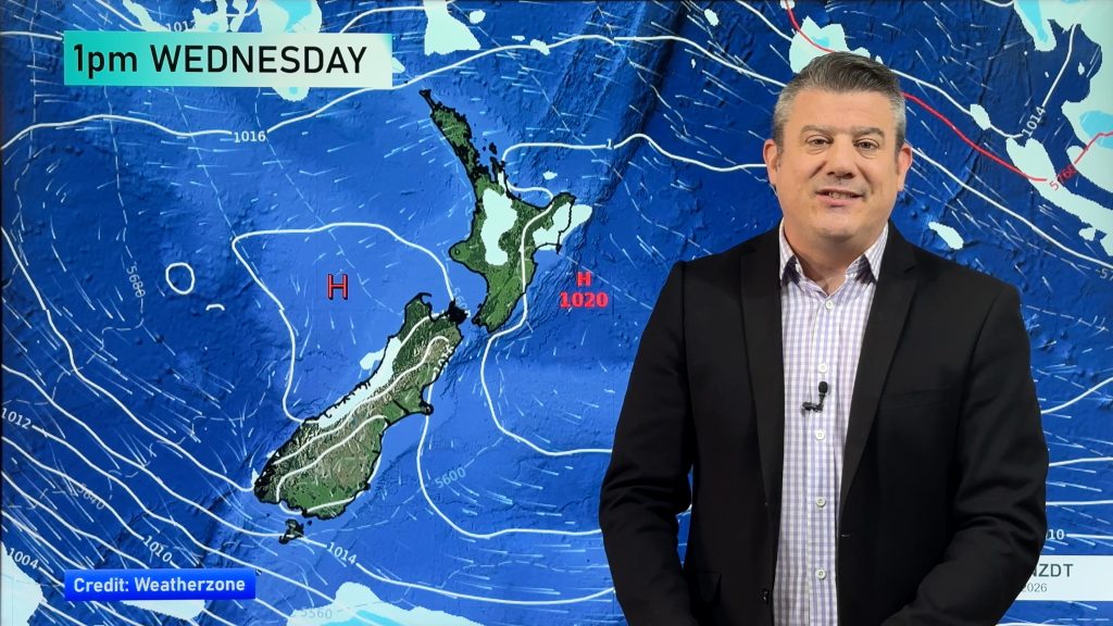
Wednesday – Heavy downpours in the upper North Island as southerlies dry out the lower North Island. By the end of the day the North Island will be drying out but a change to strong easterlies will kick in for the upper North Island with rain or showers affecting Northland, Coromandel and BOP of the most as drier weather returns elsewhere.
Thursday – A large high over the South Island balloons into the North Island pushing the wet weather back into the sub-tropics and mostly out at sea, leaving much of the North Island dry. However that windy easterly remains north of Waikato and BOP and is brisk around Northland and coastal Auckland. The cut off boundary for rain looks to be northern Auckland – so Thursday may be dry in southern Auckland and wet in rural northern Auckland. Too early to lock in the exact line but you get the idea – Auckland region looks to be the boundary for wet and dry this Thursday.
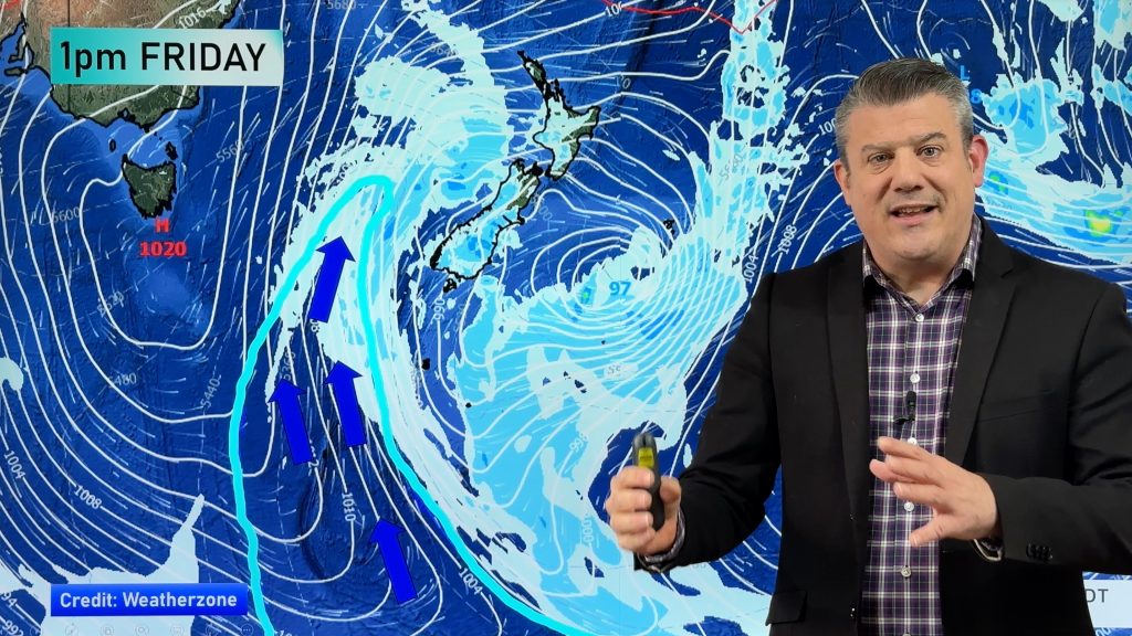
Friday – Here comes the low. It’s been sitting in the Tasman Sea all week now it’s going to drift towards all of New Zealand as the protective high pressure system over the South Island slides east and out over the Pacific Ocean. Expect easterlies to turn more NE in the upper North Island. This will push cloudy weather with showers (mostly) into Northland, Auckland, Coromandel Peninsula, BOP, Gisborne and maybe Waikato. Still plenty of dry spells though.
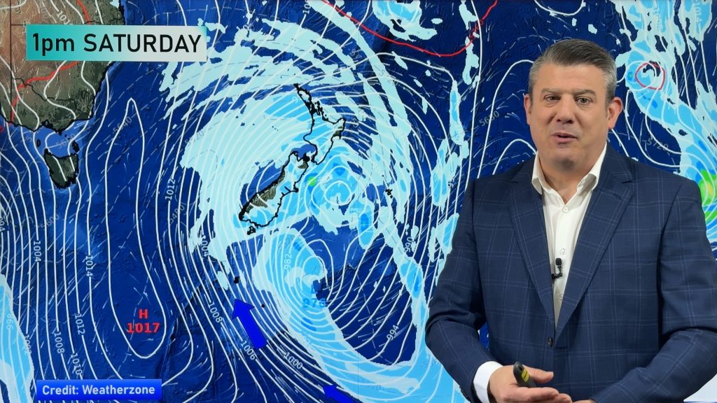
This Weekend – There isn’t non-stop rain but the winds turn more northerly, humid, and the low moves in too. Winds pick up, rain will be here and there, more persistent in Northland and Bay of Plenty. The air flow is sub-tropical coming from as far north as near Fiji. Rain also falls on the West Coast as the low moves in.
Next Monday – The low moves over the South Island and drags down more wet, weather over the North Island. Westerlies kick in (mostly nationwide) afterwards as the low tracks away into early Tuesday AM….8 days from now.
UPDATES
It’s a messy, slow, complicated set up – so the above timeline may shift a little. We’ll be providing daily updates on this event so check back. Remember all 1500 of our New Zealand 10 day forecasts now come with hourly data from Wunderground. This should also help you work out the peaks and troughs with the wind and rain over the coming days. The rain maps on our free app and website will also be useful at working out the bulk of the rain compared to the cloudy days with just a few passing showers.

– Image / This coming Saturday’s current forecast shows the airflow over northern New Zealand is coming from close to Fiji / Weathermap
– WeatherWatch.co.nz
Comments
Before you add a new comment, take note this story was published on 6 Mar 2017.


Add new comment