New Year’s Eve: Powerful Tasman Sea cold front to fall apart as it arrives in NZ (+4 Maps)
29/12/2017 3:59am

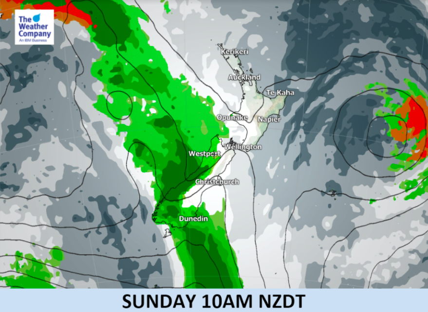
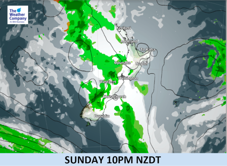
A significant cold front will cross the Tasman Sea this weekend bringing heavy rain to Fiordland and parts of the West Coast but will start to disintegrate as it heads north on New Year’s Eve.
New Year’s Eve looks fairly cloudy across New Zealand as the incoming front moves in but with the front weakening some areas may end up with drizzle patches and showers with some patchy rain too – however most of New Zealand looks dry or mainly dry.
Due to the very patchy set up we’re regularly updating our general New Year’s Eve forecast here.
Maps:
Key: Red = Thunderstorms & Rain. Dark Green = Heavy Rain. Lighter Green: Patchy rain, showers or drizzle patches. White/Grey shading = Clouds.


– WeatherWatch.co.nz (and IBM business partner, maps by TWC)
Comments
Latest Video

VIDEO: RainWatch – Will a northern low bring rain next week?
High pressure has been dominating NZ for almost two weeks now but next week there is the chance of some…
Related Articles

Weekend Newsfeed: High pressure moves in by Monday (+6 Maps)
Colder airflows will fade this weekend but the nights will still be colder due to lighter winds and high pressure…
VIDEO: RainWatch – Will a northern low bring rain next week?
High pressure has been dominating NZ for almost two weeks now but next week there is the chance of some…

The solar winter has begun… the 3 darkest months of the year
While we’re still in Autumn the “Solar Winter” has just begun – the second week of May marks the three…


Add new comment