
> From the WeatherWatch archives
Sunny spells, a few showers possible mainly this morning. Southwesterly winds.
Highs: 17-19
Western North Island (including Central North Island)
Areas of cloud with a shower or two, mostly this morning but the odd one may linger through till evening. Breezy to brisk westerlies.
Highs: 13-17
Eastern North Island
Mainly sunny with westerly winds, during the afternoon winds tend more southerly bringing some cloud and there may be a shower or two before clearing at night.
Highs: 19-20
Wellington
Mostly sunny with west to northwesterly winds tending southerly for a time this afternoon.
High: 17
Marlborough & Nelson
A mainly sunny day for Marlborough with afternoon easterlies, chance of an isolated shower late afternoon / evening for southern parts of the region. Nelson has mostly sunny weather with southwesterly breezes.
High: 18
Canterbury
High: 16-17
West Coast
Sunny spells, the odd shower especially Greymouth northwards and also about Fiordland. West to southwesterly winds.
Highs: 13-15
Southland & Otago
Showers clearing Southland this evening, some sun breaking through at times. A mix of sun and cloud about Otago, may be a shower in the afternoon / evening. Fresh west to southwest winds for most.
Highs: 13-16
By Weather Analyst Aaron Wilkinson – WeatherWatch.co.nz
Comments
Before you add a new comment, take note this story was published on 5 Nov 2017.
Latest Video
NZ weather forecast to May 1st
Heavy rain moves north of Auckland city today but remains in the north of the region and should be clearing…
Related Articles
NZ weather forecast to May 1st
Heavy rain moves north of Auckland city today but remains in the north of the region and should be clearing…
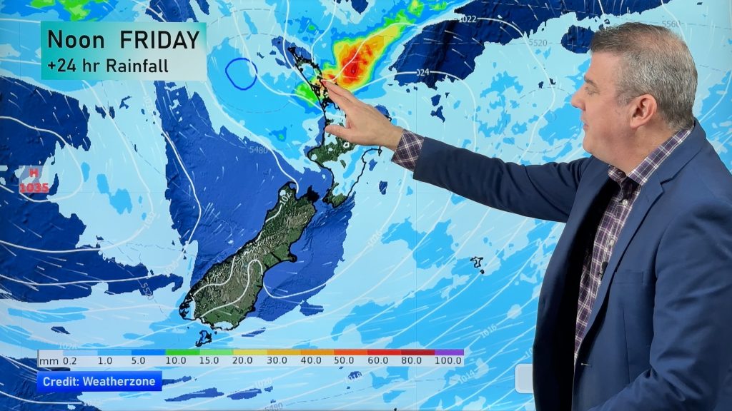
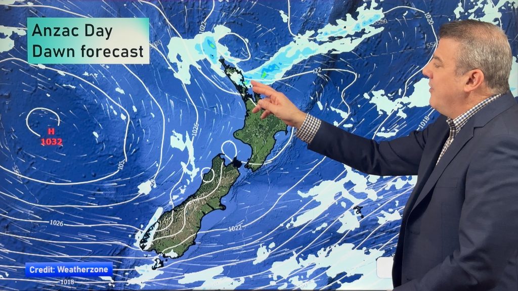
NZ: Anzac Day + long weekend weather, and how next week is shaping up
High pressure is trying to move in to NZ, but there is still the chance of some heavy rain in…
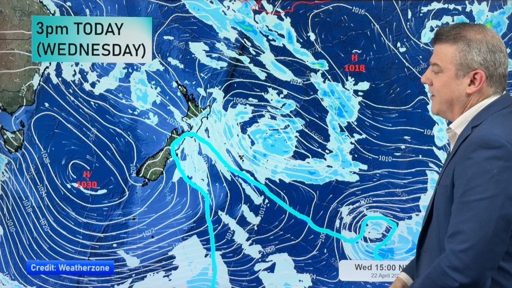
Colder air for Wed/Thu + your Anzac Day & long weekend weather
Rain, showers, some snow then possible frosts are in the forecast for the next 24 hours as the low that…


Add new comment