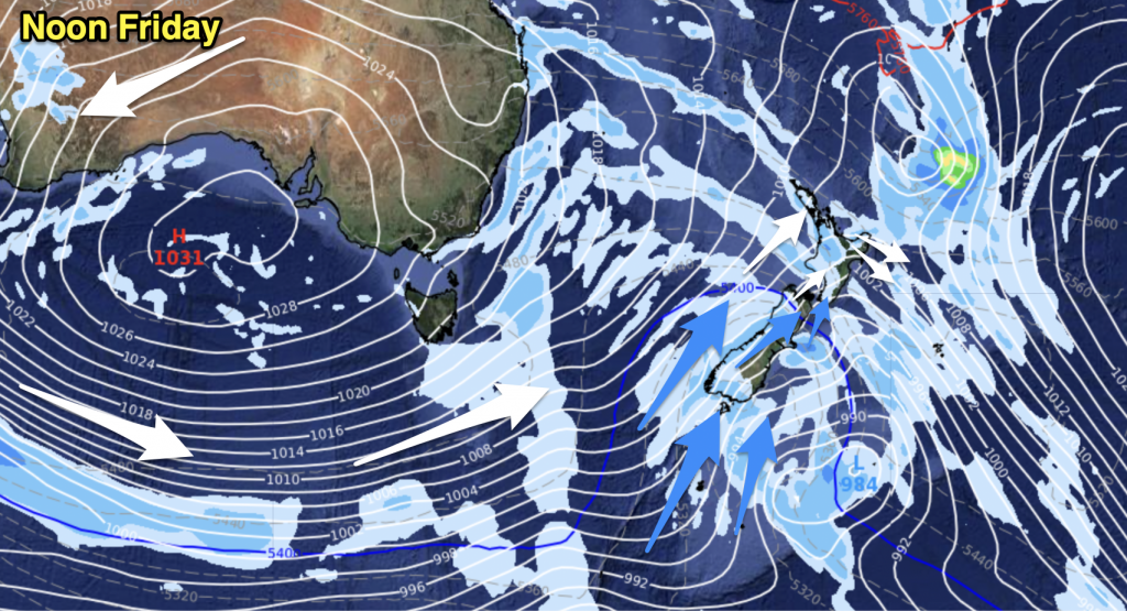
A ridge lies over the upper North Island today while northwesterlies strengthen over the rest of New Zealand. A front moves onto the lower South Island later this afternoon / evening.
Northland, Auckland, Waikato & Bay Of Plenty
Mainly sunny with light west to southwesterly winds. Afternoon sea breezes for eastern Northland and Bay Of Plenty.
Highs: 26-30
Western North Island (including Central North Island)
Sunny areas and increasing cloud, west to northwesterly winds freshen from afternoon. Late evening or overnight drizzle.
Highs: 21-27
Eastern North Island
Sunny with northwesterly breezes, some high cloud possible. Hot!
Highs: 30-35
Wellington
Thickening high cloud, overnight showers. Strengthening northwesterly winds, late gales.
High: 20
Marlborough & Nelson
Mostly sunny with some high cloud, thickening from afternoon. Overnight rain possible. North to northwesterly winds strengthen.
Highs: 24-30
Canterbury
Increasing high cloud with breezy northwesterly winds, an overnight southerly change brings showers.
Highs: 29-31
West Coast
Cloudy, rain moves into Fiordland this morning with heavy falls reaching North Westland in the evening. Northerlies freshen then changing southwest overnight.
Highs: 19-21
Southland & Otago
Thick high cloud, afternoon rain as breezy northwesterly winds change southwest. Rain clears in the evening.
Highs: 23-29
By Weather Analyst Aaron Wilkinson – WeatherWatch.co.nz


Add new comment