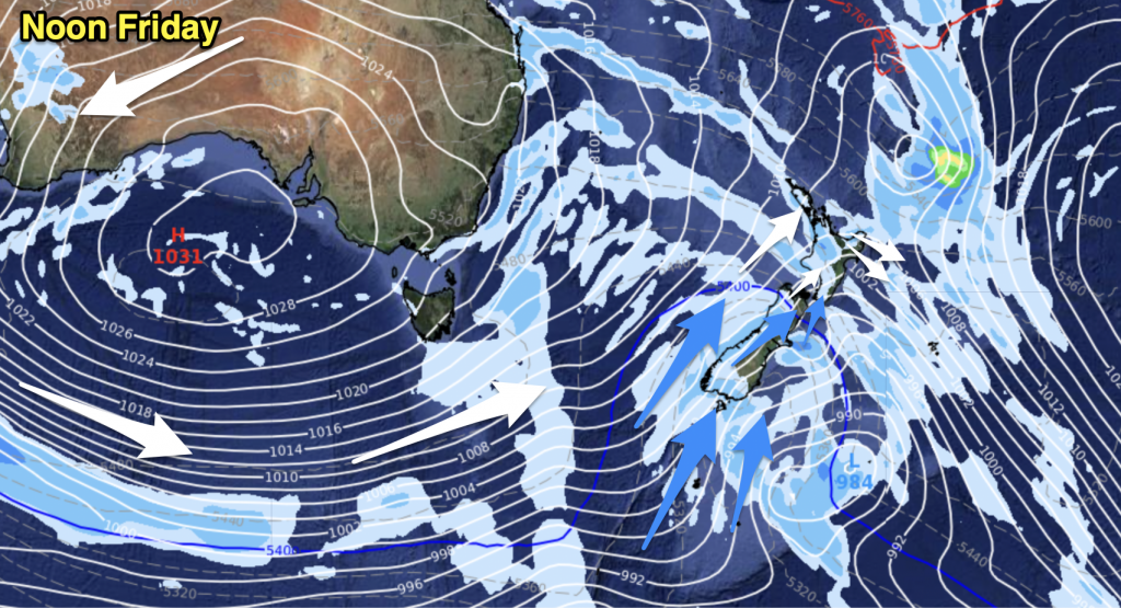
A westerly quarter airflow lies over New Zealand today, hot temperatures in the east and mainly sunny. Some cloud in the west. Rain moves into Southland and Otago this evening on a southwest change.
Northland, Auckland, Waikato & Bay Of Plenty
Morning cloud breaks to sunny areas, mainly sunny all day for the Bay Of Plenty. West to southwesterly winds.
Highs: 22-27
Western North Island (including Central North Island)
Morning cloud breaks to sunny areas near the coast, mainly sunny further inland for much of the day. Westerly winds.
Highs: 20-25
Eastern North Island
Sunny with light winds, afternoon easterlies for the Hawkes Bay and Gisborne areas. Winds tend northwest elsewhere.
Highs: 24-30
Wellington
Mostly sunny with northwesterly winds becoming brisk this afternoon.
High: 21
Marlborough & Nelson
Sunny and hot with gusty northwesterlies this afternoon for Marlborough, winds more westerly about Nelson.
Highs: 27-34
Canterbury
Mostly sunny with a touch of high cloud, northwesterly winds becoming gusty this afternoon perhaps strong inland. Hot temperatures.
Highs: 33-34
West Coast
Mostly cloudy with breezy northerly winds, cloud not thickening up about some parts of Buller till later this evening. The odd light shower about, rain moves into South Westland this evening then further north overnight.
Highs: 17-24
Southland & Otago
Sunny areas and some high cloud. West to northwesterly winds becoming gusty by midday, perhaps strong in exposed areas then a southwest change moves through this evening with some rain.
Highs: 24-31
By Weather Analyst Aaron Wilkinson – WeatherWatch.co.nz


Add new comment