Lots of events on this weekend, the weather isn’t perfect either (+5 Maps)
29/11/2018 8:07pm

A large low from the Tasman Sea is moving in to New Zealand this weekend but will weaken at the same time. It will see areas of rain, showers and afternoon downpours all moving through with large dry areas too.
There are many Christmas parades and festivals on across the country this weekend, as December kicks off – and Summer too on the meteorological calendar.
Please refer to your local 10 day and hourly forecasts for more details but here’s the latest general outlook for Saturday and Sunday and it may be a little frustrating for some in the north as the rain bands are very patchy with dry areas also in the mix. We also suggest you look at the Rain Maps in our MAPS tab to make more sense of what is moving through.
On Saturday there will be patchy areas of rain around the country. On Sunday heavy downpours with isolated thunderstorms and large dry areas look most likely. Either way it’s a tricky one to be overly precise about which means for many organising events (and heading to them) some planning may come down to the wire as we track various downpours and dry areas.
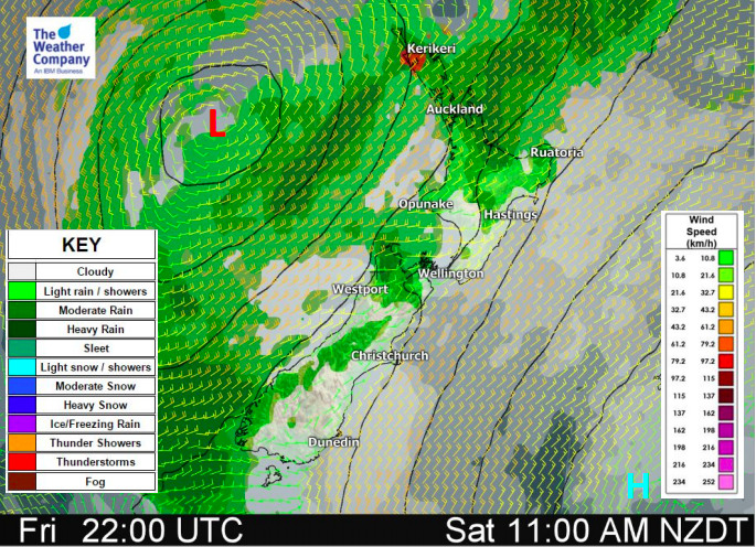
4PM SATURDAY: Main areas of rain in blue or yellow. Showers or patchy lighter rain in pink/purple.
4PM SUNDAY – Downpours flaring up in both islands, a chance of isolated thunderstorms. (Maps by MetOcean)


– WeatherWatch.co.nz
Comments
Latest Video

Weekend Newsfeed: Winter weather in the south, high pressure in the north
A cold change is affecting the lower half of the South Island Saturday bringing snow to the hills and ranges…
Related Articles
Weekend Newsfeed: Winter weather in the south, high pressure in the north
A cold change is affecting the lower half of the South Island Saturday bringing snow to the hills and ranges…

VIDEO: 7 Day NZ RainWatch: Who gets rain, who misses out
A cold front will bring winter-like weather into the lower South Island on Saturday but won’t make to the top…

MetService Auckland rain radar offline – helicopter called in
Aucklanders may have noticed the rain radar isn’t working this week. MetService has provided us with an update ahead of…


Add new comment