
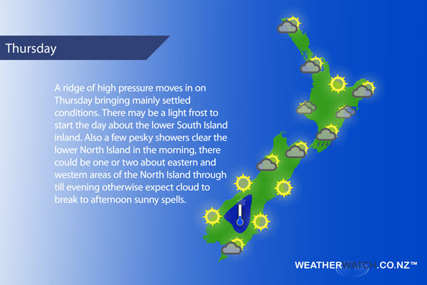
A ridge moves in on Thursday bringing a more settled looking picture, however there is still some cloud and a few showers about the North Island to gradually clear away.
A mix of sun and cloud for the upper North Island with west to southwesterly winds. The Bay Of Plenty is mostly sunny. Cloudy areas with a shower or two possible for the lower western North Island, clearing early afternoon then areas of sun increase. West to southwesterly winds, breezy about the Taranaki coast.
Areas of cloud along the east coast, sun breaking through at times. Risk of a shower or two otherwise mainly dry. Southwesterly winds. Early showers clear Wellington then becoming mainly sunny, southerlies ease then die out by evening.
Morning cloud clears then becoming mostly sunny about Nelson and Marlborough, light winds tend north to northeasterly in the afternoon. Mainly sunny for Canterbury, afternoon east to northeasterly winds.
Mostly sunny along the West Coast, some morning cloud breaks away from about Greymouth northwards. Evening cloud about South Westland then some overnight rain or perhaps more towards dawn on Friday. North to northwesterly winds develop. Sunny for Southland and Otago after any coastal morning cloud clears, westerlies tend east to northeast late afternoon. Light winds inland with a light frost possible to start the day.
Blue – Heavy form of precipitation – or – low temperatures, typically below 1 to 2 degrees celsius.
White – Snow
Purple – Strong winds.
Yellow – Temperatures around the mid 20 degree mark or over.
Not all regions and towns have been mentioned above. For specific 10 day information for your city, town, rural community or island please see the 1500 forecasts on our homepage!
– Aaron Wilkinson, WeatherWatch.co.nz
Comments
Latest Video

VIDEO: Anzac Day + weather to next Tuesday
Anzac Day looks mild for many parts of NZ with windy nor’westers gusting to gale force for some. Many regions…
Related Articles

Weekend Newsfeed: High pressure arrives, dragging in some cloud, more settled nationwide
Sunday – High pressure crosses NZ properly and winds ease for many regions and most (but not all) showers will…

Anzac Day Newsfeed: Severe gales, heavy rain for some, settled for others
Updated 4am — High pressure over northern NZ moves east of the country on Thursday while a storm south of…
VIDEO: Anzac Day + weather to next Tuesday
Anzac Day looks mild for many parts of NZ with windy nor’westers gusting to gale force for some. Many regions…


Add new comment