
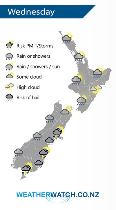
A west to southwesterly airflow lies over New Zealand on Wednesday, becoming unstable for the eastern South Island in the afternoon.
A few patchy showers for the western North Island on Wednesday, clearing in the evening for most although the odd one may hang about Northland till overnight. Mainly dry in the east with some high cloud, late afternoon or evening southerlies may bring some lower level cloud and the risk of a shower.
Occasional showers for the West Coast of the South Island, clearing evening. The odd shower for the south and east of the South Island, showers may become heavy with hail / thunder in the afternoon then easing evening. Unstable activity mainly Otago Peninsula northwards through into North Canterbury.
By Weather Analyst Aaron Wilkinson – WeatherWatch.co.nz
Comments
Latest Video

VIDEO: NZ’s Autumn showers + sub-tropical developments
NZ has a classic Autumn sou-wester today and this eases into Friday and the weekend. Next week low pressure forms…
Related Articles
VIDEO: NZ’s Autumn showers + sub-tropical developments
NZ has a classic Autumn sou-wester today and this eases into Friday and the weekend. Next week low pressure forms…

Thursday Newsfeed: A south-west flow across the country
A south-westerly flow has spread across NZ and will continue to do so for Thursday, Friday and Saturday. Windiest weather…

ClimateWatch: MAY’s outlook as El Niño ends, NEUTRAL pattern arrives (+Video & 13 Maps)
El Niño may be technically gone but the weather pattern it created is still with our part of the world. By…


Add new comment