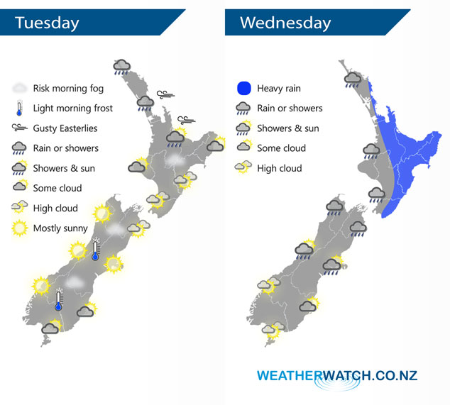
InfoGraphic: The Big Picture for Tuesday / Wednesday
2/09/2019 7:00pm

An anticyclone weakens over New Zealand today especially over the North Island where easterlies build and a low to the northwest moves closer during the day. This low affects most of our weather on Wednesday.
Thickening cloud for much of the North Island today, rain about Northland gradually spreads southwards during the day over the upper North Island. Easterly winds becoming gusty offshore. The South Island has mostly sunny weather, perhaps some morning mid level cloud about the far south. Areas of fog or mist possible for inland areas this morning.
Rain or showers for most of the North Island on Wednesday, rain may be heavy in the morning especially about the northeast then easing during the afternoon. Rain develops about Nelson / Marlborough in the morning then spreading into Canterbury during the afternoon. Plenty of high cloud about the far south, mainly dry although coastal Otago sees some drizzle by evening then a chance of overnight rain.

By Weather Analyst Aaron Wilkinson – WeatherWatch.co.nz


Add new comment