
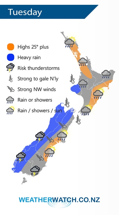
A cold front pushes in from the west on Tuesday, heavy rain for some western regions and a few scattered falls spreading eastwards.
Showers then afternoon rain for the upper / western North Island, easing back to showers by evening. Thick high cloud out east with a few spots of rain about Wairarapa in the afternoon then Hawkes Bay / Gisborne late afternoon or evening.
Heavy morning rain for the West Coast of the South Island then easing to showers, some may be heavy with thunderstorms especially for South Westland. Morning rain in the east then becoming mostly sunny in the afternoon with strong northwesterlies. Showers about Southland early afternoon could become heavy with thunderstorms.
By Weather Analyst Aaron Wilkinson – WeatherWatch.co.nz
Comments
Latest Video

VIDEO: Anzac Day + weather to next Tuesday
Anzac Day looks mild for many parts of NZ with windy nor’westers gusting to gale force for some. Many regions…
Related Articles

Weekend Newsfeed: High pressure arrives, dragging in some cloud, more settled nationwide
Sunday – High pressure crosses NZ properly and winds ease for many regions and most (but not all) showers will…

Anzac Day Newsfeed: Severe gales, heavy rain for some, settled for others
Updated 4am — High pressure over northern NZ moves east of the country on Thursday while a storm south of…
VIDEO: Anzac Day + weather to next Tuesday
Anzac Day looks mild for many parts of NZ with windy nor’westers gusting to gale force for some. Many regions…


Add new comment