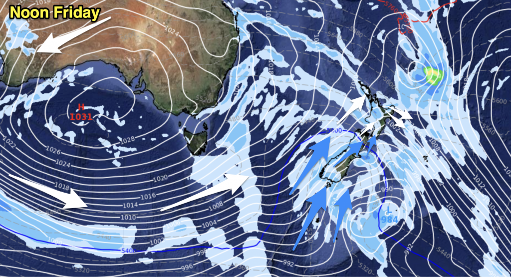
For the short term future the widespread frosts are about to end thanks to a northerly change late in the week with potential flooding rains possibly on the way for the weekend.
The Weather Watch Centre predicts frosts will return to many regions overnight tonight then again overnight Tuesday however clouds and a change to northerlies are predicted to arrive during Thursday in the north and spread south.
Weather analyst Philip Duncan says northern New Zealand will be the first to feel the warmer weather. “We should see northerlies building towards Thursday with clouds coming in. Rain will spread east from the Tasman Sea on Friday and into the weekend with heavy falls possible. This low will be coming from the sub-tropics and is something we’re keeping a close eye on it”.
Mr Duncan says northern and western facing regions of both islands look likely to be most exposed to the low. “We’re still reading through the data and computer models but this system does have the potential to bring flooding in to some areas”. Mr Duncan says the low may possibly be classed as a ‘weather bomb’ which is when the air pressure falls at a fast rate within a 24 hour period (1hPa per hour).
Computer models this far in advance can swing wildly however all models and data used by the Weather Watch Centre agree a large low will form in the Tasman Sea later this week.


Add new comment