Easter weekend and beyond – your holiday situation & outlook
2/04/2015 8:00pm

> From the WeatherWatch archives
As we head into the long weekend, we’re looking at a couple of interesting weather systems developing over the country.
It’s fair to say we’ll have a mixed bag across much of New Zealand – with a combination of sun, cloud and showers – so check out your prospects over the weekend and into next week, below.
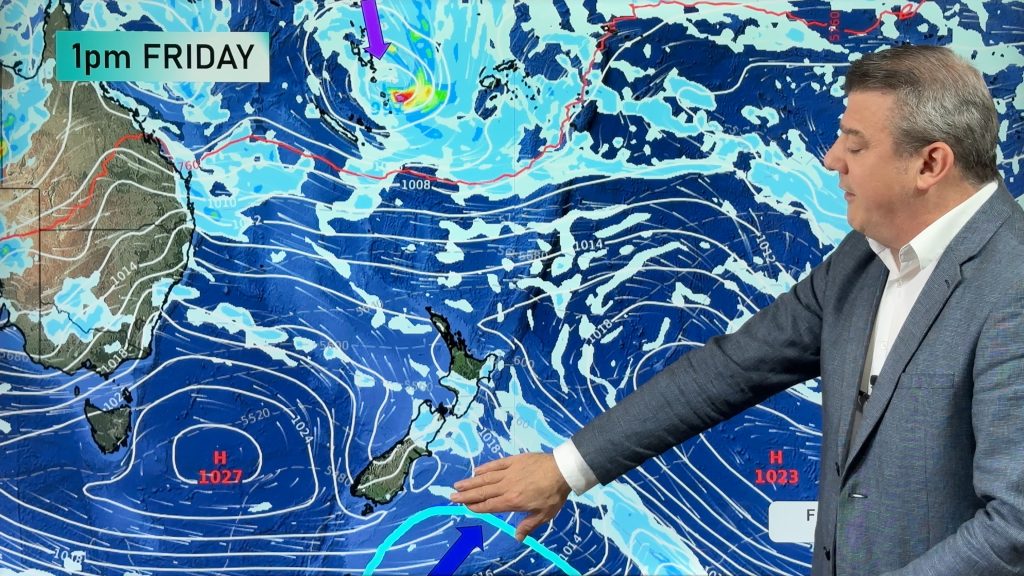
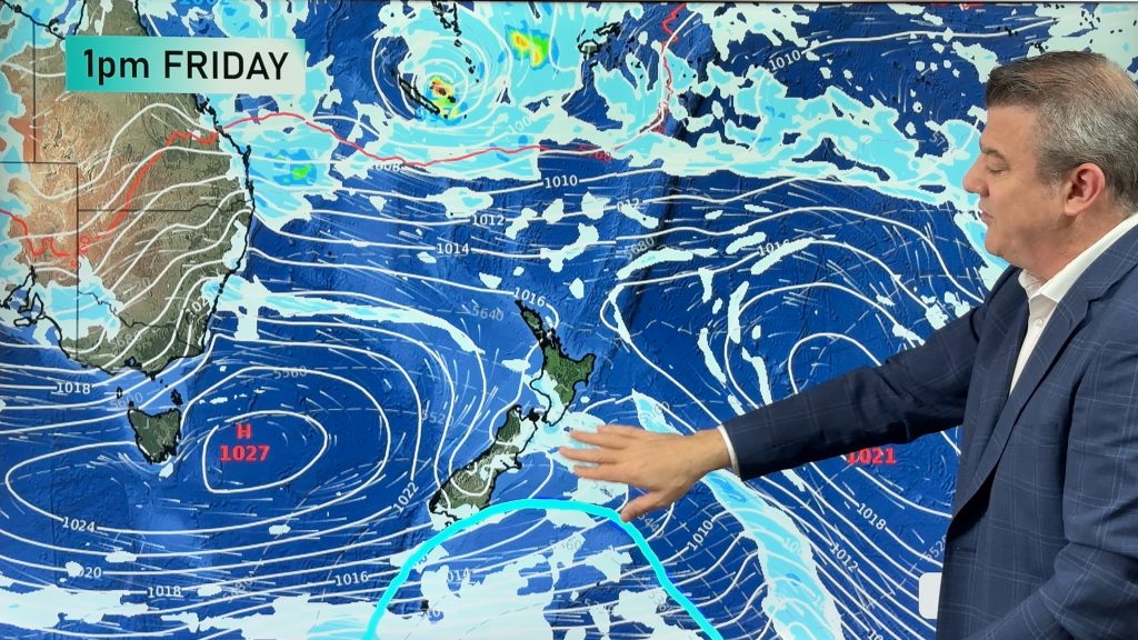
Friday
Over the North Island, there will be cloudy areas in the west, along with some westerly quarter winds.
Sunshine breaks through for many interior parts in the afternoon – Waikato and the Central North Island.
Auckland has sunny areas and some cloud with cloud starting out thicker first thing this morning.
Northland and the rest of the North Island are looking at a mostly sunny day, with light winds this morning and afternoon sea breezes.
The South Island has mostly sunny weather from Southland, right up the east coast through to Nelson.
Winds will be from the northwest for inland areas, and you can expect northeasterlies near the coast in the east, and high cloud at times.
The West Coast has cloudy areas with sunny spells at times from Greymouth northwards, while South Westland – and Fiordland in particular – has patchy drizzle during the day, then overnight rain will move into South Westland.

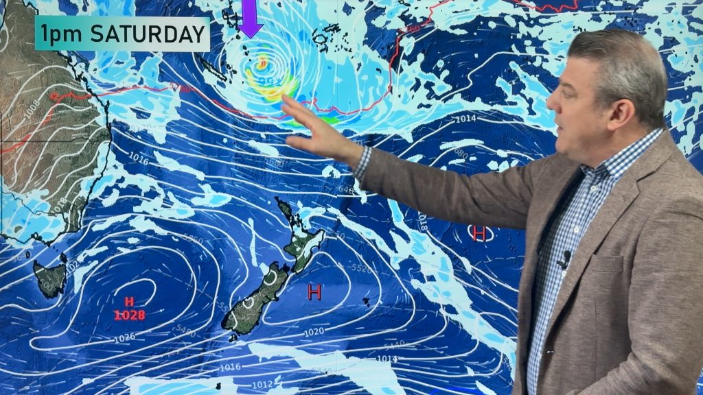
Saturday
A front moves northwards over the South Island during the day, reaching the lower North Island in the evening.
Ahead of the front, we can expect a strong northwesterly airflow, and cooler west to southwest winds behind.
The North Island has increasing cloud in the west, with a few showers possible at times from afternoon in the west, along with winds coming in from the west.
Sunnier out east, and for the Bay Of Plenty with some high cloud.
Morning rain on the West Coast of the South Island, and also about Southland and Central Otago – then easing to showers for all, as northwesterlies change west to southwest.
Just some high cloud for other South Island regions, with gusty northwesterlies North Canterbury northwards in the east, perhaps a few brief spells of rain passing over from the west around midday.
Southerlies then push into Canterbury mid to late afternoon, bringing some cloud.

Sunday
A mixed bag of a day on Sunday, as a high pressure mostly dominates over New Zealand – however it isn’t the clear sunny picture holiday makers are looking for…
For the North Island, Northland through to the Waikato has cloudy areas and light winds, perhaps a few showers about too – especially in the afternoon.
Expect cloud from Gisborne to Wairarapa in the east, with the chance of a shower or two, while it’s looking like sunnier spells out west with east to southeasterly winds.
The South Island sees cloudy skies along the east coast and about Nelson and Marlborough, with a patchy shower or two also.
Getting into South Westland, Southland and Central Otago, skies are looking sunnier – with easterly quarter winds.

Monday
High pressure moves eastwards, as a northerly airflow increases over New Zealand for Easter Monday.
That airflow covers the North Island, which can expect sunny areas and some cloud for most – although about Auckland southwards through to the Manawatu and over to the Bay of Plenty, cloudier skies may deliver a shower or two – especially in the afternoon.
The South Island sees high cloud thickening from morning for all, while north to northeasterly winds increase during the day and become gusty about coastal areas from afternoon – especially South Westland, where winds will be strong.
Patchy showers move onto the West Coast early on, then turn to rain in the afternoon, and become heavy later on and overnight.
A few spells of rain then push over the divide into Southland and Otago in the afternoon, before clearing up in the evening.

Tuesday
A high sits out to the east of the North Island in the Pacific Ocean, while a northerly airflow remains over most of New Zealand.
Embedded in this flow is a front feeding into the South Island’s West Coast.
So for the North Island the day isn’t shaping up too bad, with sunny areas and high cloud with northerly quarter winds for most.
Taranaki and Kapiti may catch some thicker cloud, and the odd shower, during the day.
For the South Island, rain clears from South Westland early on, then continues about North Westland.
During the afternoon a second frontal system moves onto the West Coast, bringing rain for all areas again, before becoming heavy by evening.
About Nelson, Marlborough and Canterbury expect thick high cloud, and a few spells of rain spreading at times from the west – especially Nelson and Marlborough.
Winds for most regions will be gusty from the northwest.
Southland and Otago may be the exceptions with high cloud, light winds and mainly dry conditions – although towards evening some scattered rain will push down from the north into the lower South Island also.
– Aaron Wilkinson & Drew Chappell, WeatherWatch.co.nz
– Maps: Google
Comments
Before you add a new comment, take note this story was published on 2 Apr 2015.
Latest Video
High pressure, cold fronts & a potential offshore tropical storm
We still have summer weather left – but as end the month of February and kick off March we do…
Related Articles
High pressure, cold fronts & a potential offshore tropical storm
We still have summer weather left – but as end the month of February and kick off March we do…
Monitoring potential tropical storm + southerly change arrives Sunday
High pressure smothers New Zealand today but a cold front is coming on Thursday, and a colder/cooler southerly change for…
Feb’s last week: High pressure, cold fronts and a tropical low
The weather this week smacks of late February with some settled, warm, dry days in the mix – along with…


Add new comment