
> From the WeatherWatch archives
A thunderstorm that has been rattling homes across Southland for the past 45 minutes is set to continue for a while longer as a low deepens just off the coast sending unstable weather conditions across the region.
Invercargill Weather Watch reporter Malcolm Gayfer says it’s been non stop since just after 1pm. “It’s been a continuous thunderstorm for the past 45 minutes. If it was night time it would be a spectacular display”.
 And in the past few minutes Malcolm says a huge hail storm has started. “This is the most sudden and heaviest hail storm I have ever seen in Invercargill in the 20 years I’ve lived here”. The hail storm was so loud it drowned out our interview with him on the phone.
Tomorrow a cold sou’wester will kick in with Invercargill predicted to have a high of just 12 or 13 degrees and a low of around 6 according to WeatherWatch.co.nz.
Malcolm Gayfer says they are still waiting for summer to start.
Hail the size of “Jaffas” fell across parts of Southland around 2pm today. Image / Tracy Kilkelly
WeatherWatch.co.nz says the region has had strong or gale force winds every week since October and no immediate end is in sight.
Head weather analyst Philip Duncan says the unstable weather pattern this summer is having the biggest impact on the South Island’s western and southern coastlines. He says it may be February before conditions start to ease for Southlanders and even then there is no guarantee.
“We need to see more anticyclones moving in from southern Australia to bring a settling of weather conditions to the South Island. So far this Summer the highs have been in the northern Tasman Sea which has fed changeable weather across the lower North Island and the entire South Island.
Comments
Before you add a new comment, take note this story was published on 7 Jan 2010.
Latest Video
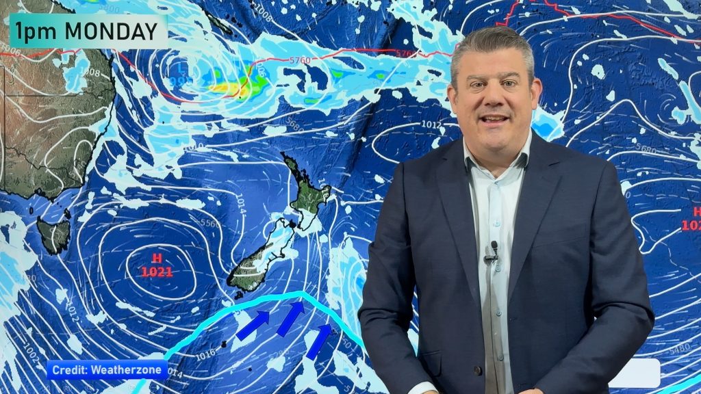
High pressure in charge, but also monitoring a tropical low next week
High pressure continues to dominate NZ’s weather as a tropical cyclone forms in the Coral Sea today. The cyclone, which…
Related Articles
High pressure in charge, but also monitoring a tropical low next week
High pressure continues to dominate NZ’s weather as a tropical cyclone forms in the Coral Sea today. The cyclone, which…
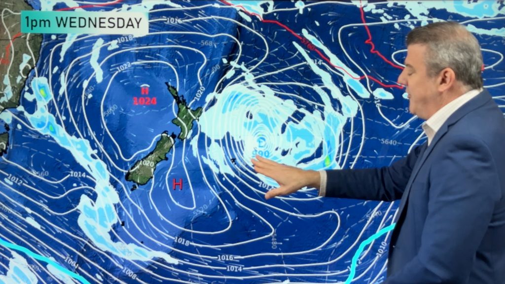
Yes, NZ’s weather is warming back up again
Temperatures lift on Wednesday for many, then further going into Thursday and Friday as subtropical and/or nor’westers return. Cooler southerlies…
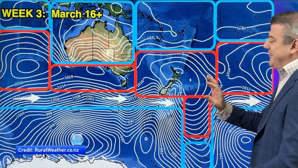
ClimateWatch: MARCH is looking quite orderly to start with
Storms near Antarctica, Autumn’s westerlies building south of Australia & NZ, high pressure again affecting both nations and the tropics…


Add new comment