Cold front moves up NZ Christmas Day & Boxing Day – expected rainfall totals (+8 Maps)
23/12/2017 9:33pm

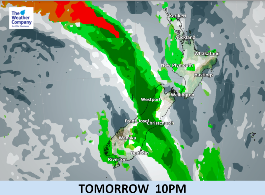
A northerly flow will build over the country today and across Christmas Day with a cold front moving up the South Island slowly bringing a colder change behind it.
It will be hot on Christmas Day for many inland and eastern areas of both islands (30 degrees quite likely in the east), but the cold front and cooler air behind it will reach about as far north as Westport to Christchurch before midnight on Christmas Eve, then into the lower North Island on Boxing Day morning.
Winds off the sea may keep some northern areas a little cooler on Christmas Day but just a little further inland and sheltered areas will also be hot for the next couple of days ahead.
On Boxing Day the rain band moves into the North Island with a cooler southerly change and a few isolated heavy falls but many areas of patchy lighter rain or even drizzle – which may be disappointing to many who need it the most.
WeatherWatch.co.nz says the front will likely weaken as it heads further north on Tuesday with a very large high coming in behind it from Wednesday until December 31st. (And yes, we think New Year’s Eve looks dry for a lot of NZ).


– WeatherWatch.co.nz
Comments
Latest Video

VIDEO: Anzac Day + weather to next Tuesday
Anzac Day looks mild for many parts of NZ with windy nor’westers gusting to gale force for some. Many regions…
Related Articles

Monday Newsfeed: The forecast as we say goodbye to April, hello to May…
In true Autumn style the big picture weatherwise around New Zealand this week is a bit of “everything off the…

Meteors – Your Eyewitness Reports!
WeatherWatch.co.nz receives meteor reports from all over New Zealand and the globe, 24/7/365. **CASUAL COMMENTS**If you’ve seen something in the…

Weekend Newsfeed: High pressure arrives, dragging in some cloud, more settled nationwide
Sunday – High pressure crosses NZ properly and winds ease for many regions and most (but not all) showers will…


Add new comment