Centre of massive high moves in, makes things a little messier actually
28/06/2019 7:00pm

Forecasters know that when they don’t have to work such long hours the weather is settled – that’s been this past week but now the centre of this calming high is rolling in and that means the weather is actually going to start to change.
For the past week the generally flow across the country was a gentle southerly quarter flow which then turned easterly at the top of the country, over Northland. Further south this southerly flow was so light that many forecasts probably just said “light winds” or “calm” – but the frosts were a give away!
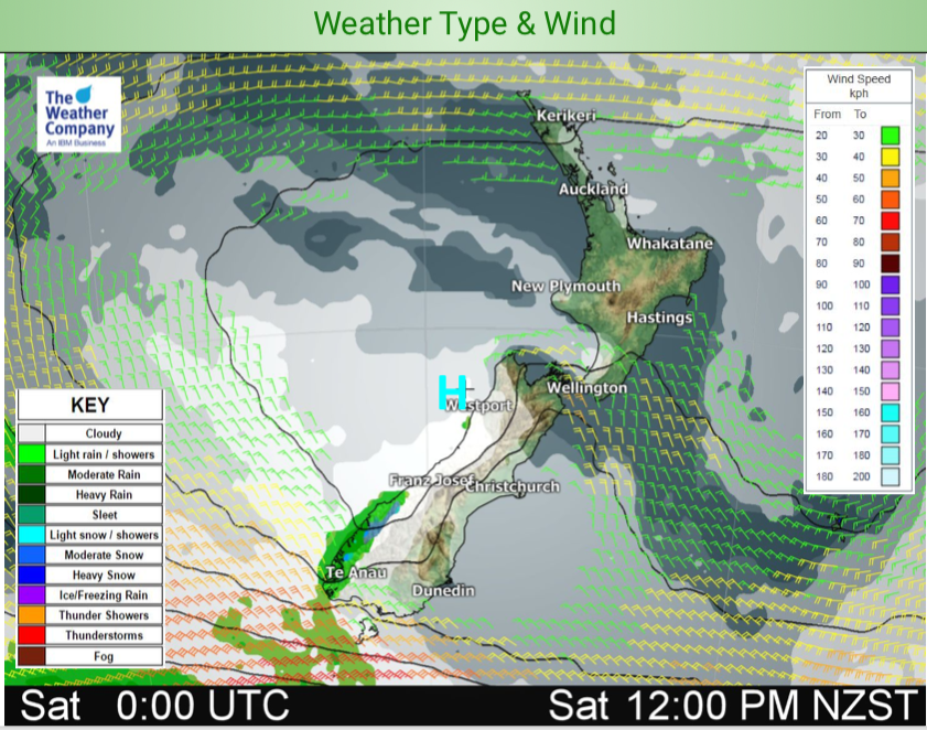
With that side now fading as the centre comes in, we’ll start to get the left hand side of the high and that means more cloud, more warmth and a chance of some wind. It’s nothing major but cloudier spells are perhaps a bit more likely in coastal regions and, for Saturday anyway, a bit of a breeze through the Southern Alps and Cook Strait/lower North Island. A couple of light showers are possible in the west on Saturday too as the centre of this high transits from Tasman Sea to Pacific Ocean, but it’s such a low risk we’d still say “hang your washing out to dry”.
Sunday looks calm but by Sunday evening the high drifts further east of the country and behind it comes a much warmer sub-tropical flow that will spin a rainmaking low pressure system mid to late next week — before the next big high rolls in from Australia.
– WeatherWatch.co.nz
Comments
Latest Video

Weekend Newsfeed: Winter weather in the south, high pressure in the north
A cold change is affecting the lower half of the South Island Saturday bringing snow to the hills and ranges…
Related Articles
Weekend Newsfeed: Winter weather in the south, high pressure in the north
A cold change is affecting the lower half of the South Island Saturday bringing snow to the hills and ranges…

VIDEO: 7 Day NZ RainWatch: Who gets rain, who misses out
A cold front will bring winter-like weather into the lower South Island on Saturday but won’t make to the top…

MetService Auckland rain radar offline – helicopter called in
Aucklanders may have noticed the rain radar isn’t working this week. MetService has provided us with an update ahead of…


Add new comment