Afternoon thunderstorms and heavy downpours this weekend in NZ – we track where (+3 Maps)
12/01/2018 10:00pm

An area of lower air pressure over the Tasman sea is slowly approaching New Zealand.
Between this area of low pressure to the west and a high pressure system to the east, sub-tropical northerly winds dominate over the entire country.
It’s this air flow that will see Southland reach 30 degrees on Sunday and Monday and overnight lows in northern New Zealand possibly not below 20 degrees for some with high humidity.
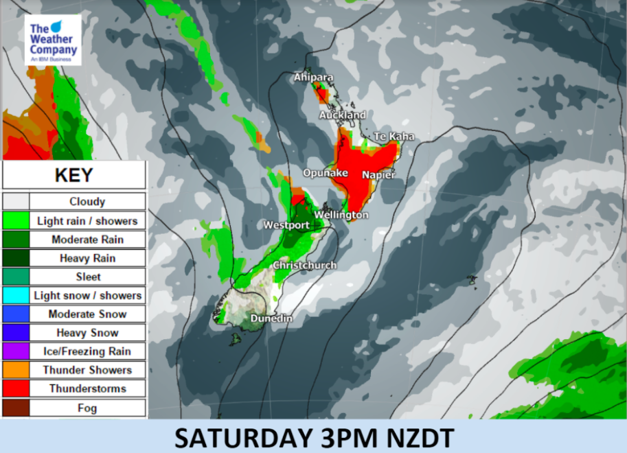
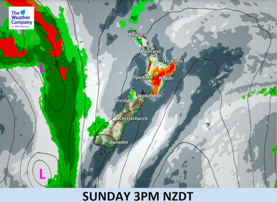
Stray thunderstorms are likely in the North Island mainly in interior areas on Saturday and Sunday. Some storms may be severe and could produce flash flooding.
Temperatures are markedly warmer than usual in the South Island until Tuesday.

– WeatherWatch.co.nz (maps by The Weather Company, an IBM business)
Comments
Latest Video

VIDEO: RainWatch – Will a northern low bring rain next week?
High pressure has been dominating NZ for almost two weeks now but next week there is the chance of some…
Related Articles
VIDEO: RainWatch – Will a northern low bring rain next week?
High pressure has been dominating NZ for almost two weeks now but next week there is the chance of some…

Weekend Newsfeed: High pressure moves in by Monday (+6 Maps)
Colder airflows will fade this weekend but the nights will still be colder due to lighter winds and high pressure…

The solar winter has begun… the 3 darkest months of the year
While we’re still in Autumn the “Solar Winter” has just begun – the second week of May marks the three…


Add new comment