
> From the WeatherWatch archives
Updated Saturday — We are getting a lot of similar questions, so we thought a simple lay out like this might help you navigate our site to find precisely what you need. Below are 10 of the most commonly asked questions to us this week from across New Zealand and should answer your question(s):
1) Will it snow at my place?
We have 1500 forecast locations, covering just about every small Kiwi Community, town and suburb. If for some reason your area isn’t there use “find my nearest location” and we’ll find a forecast that’s very close to you. The main centres highlighted in yellow are the detailed forecasts we write at WeatherWatch.co.nz: Click Here to Search to see if snow will fall at your place.
2) Will the snow be widespread and heavy for everyone?
No. The colder the air gets the drier it becomes and so the fewer snow clouds there are. Today the snow showers ease along the South Island’s east coast but intensfies around the North Isand’s east coast. Fewer people will be impacted by snow on Sunday nationwide but the North Island’s east coast has heavy snow (as does Central Plateau) until Sunday AM.
3) Will I be able to build a snow man?
The main centres look likely to miss out on snow heavy enough – but the good news is with skies clearing into Sunday and next week people should be able to set out and find it if they feel up for a drive (make sure the roads are clear of black ice and snow first by checking with roading authorities). Check NZTA website for travel information and please do take extreme care.
4) How brutal will the wind chills be?
In the South Island anywhere from -5 to -15 in some exposed farming and growing communities – view our 14 day wind chill animation here. Hopefully wind chills will be short lived as high pressure starts to roll in – but overnight lows in inland South Island areas, like Alexandra, will drop below -11C in the calm conditions (see the story on our homepage right now!)
5) What are the main weather features coming over the next three days? Gales, snow, rain:
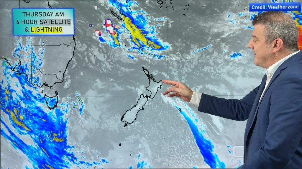
Take a look at our 3 day infoGraphic
6) Do you have Highway forecasts for some of the main higher altitude roads?
Yes some, check out our forecasts here for both North and South Island highways that may be affected by snow or sub-zero temperatures creating ice/black ice. Click here to view. Also, please check MetService.com for their road snowfall advisories.
7) Will snow/ice affect travel?
Yes/maybe -we think some highways will be affected in both islands by snow and ice. However snow shouldn’t cause too many issues for air travellers in our view – Please check airline and airport websites for additional information. Click Here to view our news story and forecasts about the NZ Airports most exposed to this wintry weather.
8) Is this is a storm?
No. It’s just a cold Antarctic airflow that’s hitting a low over the North Island. The heaviest snow occurs when cold Antarctic air hits warmer moist air. However a deepening low over the North Island on Saturday may become stormy, creating areas of gales – also heavy rain and a “snow storm” around and over much of the central/eastern North Island.
9) What do you mean it’s too cold to snow?
Antarctica is one of the driest places on earth – high pressure dominates the South Pole and temperatures are generally extremely low there. So the air flow from Antarctica is not what brings the snow by itself – it needs to hit moist air over/near New Zealand. It’s the cold air hitting moist warmer air over New Zealand that often creates our biggest snow storms (that is happening today over Hawke’s Bay). Most of the heaviest snow from this event looks to be in the mountains and above a few hundred metres.
10) Why is snow so hard to forecast in coastal NZ?
Snow to sea level is hard in New Zealand due to our surrounding oceans. On top of that our big mountains and ranges in each island cut off and change airlfows – so even when snow is coming in from the south, the hills around Southland (for example) can sometimes block snow and moisture reaching Canterbury. So both the sea temperatures and airflows around our mountains make snow forecasting to low more populated levels very tricky – but we love a good challenge! It’s important to note that working out if it will snow to sea level – and then how much snow will fall – can be incredibly pedantic work, as forecasters stress over something as small as a 1 or 2 degrees difference between cold rain and heavy snow – that’s often what it comes down to. Not like Canada or the US when a cold front brings -10C to everyone and everyone gets snow during that process – that process is much easier to forecast than the borderline temperatures in our two coastal mountainous main islands!
– WeatherWatch.co.nz
Comments
Before you add a new comment, take note this story was published on 5 Aug 2016.
Latest Video
High pressure for much of the country: 10 day outlook
Powerful high pressure is moving over New Zealand not only for this weekend but possibly for the next couple of…
Related Articles
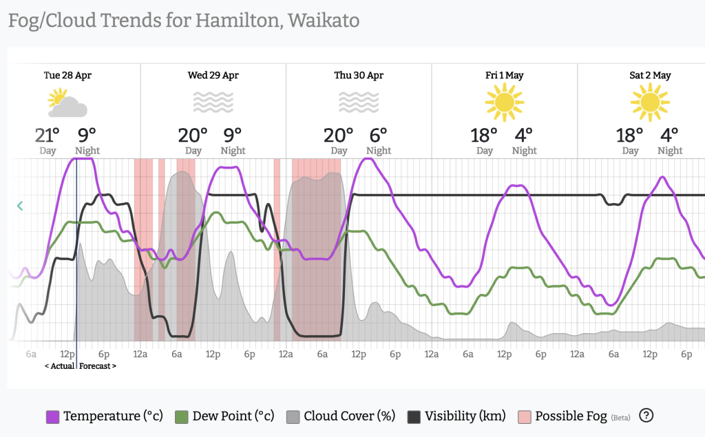
Foggy weather off & on next couple of weeks
High pressure in Autumn usually leads to fog and our unique fog forecaster can better help you plan ahead, especially…
High pressure for much of the country: 10 day outlook
Powerful high pressure is moving over New Zealand not only for this weekend but possibly for the next couple of…

Wed April 29 – No video today sorry!
Apologies but due to some tech hassles with our camera (and a fairly quiet weather forecast) we don’t have an…


Add new comment