
A large swathe of Western Australia’s west is about to be hit by a lengthy burst of intense wind and rain, and for the coasts abnormally high tides and beach erosion.
Wind and waves have potential to be intense enough for long enough to cause damage for 12-to-24 hours in some areas. Rain and showers, which are likely to persist for 18-to-24 hours, have potential to be heavy for six-to-12 hours in some areas.
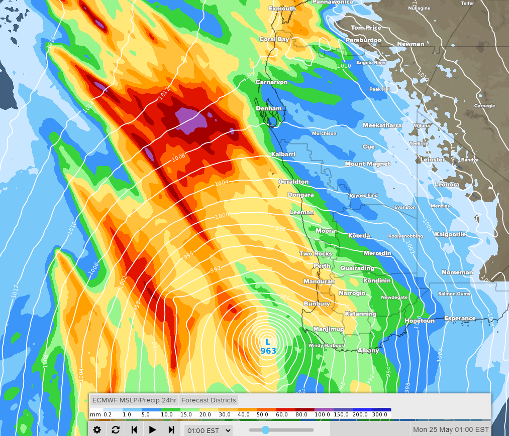
Image 1: Forecast accumulated 24-hour rainfall and mean sea level pressure on Sunday night, according to the ECMWF-HRES model.
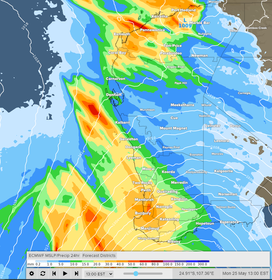
Image 2: Forecast accumulated 24-hour rainfall and mean sea level pressure late on Monday morning, according to the ECMWF-HRES model.
In terms of the vast area to be affected (extending as far as 500km inland) and the intensity and variety of weather likely to be experienced, this can be classed as a rare event.
The event is so unusual that computer models have a fair chance of underestimating the outcome. How intense the weather gets depends highly on how close the lows get to the close which is still uncertain. At this stage, the more intense low is likely to travel close to the southwest capes but remain offshore.
Factoring all of the above, residents near the west coast should be prepared for wind gusts in excess of 100km/h, rainfall amounting to more than 50mm and waves higher than 5 metres in the vicinity of beaches.
For areas away from the coast, the more exposed elevated areas are likely to be hardest hit by wind. However, as far as 400km inland, the wind is expected to generally be less intense aand rain only light.
The driving synoptic features are intense low pressure systems (spawning off Ex-Tropical Cyclone Mangga), the funnelling of copious amounts of moisture and an interacting cold front.
As a result, this will turn out to be a weekend of two halves – pleasantly warm and sunny on Saturday; windy, rainy and colder on Sunday.
By Brett Dutschke, Weatherzone.com.au
Comments
Latest Video

VIDEO: RainWatch: Northern rain, then powerful high next week, but more rain next weekend?
A weak area of low pressure will move across the upper North Island this weekend and bring more welcome rain…
Related Articles

VIDEO: Australia-only 7 Day: Wet easterly vs cold southerly
Wet weather and windy easterlies for eastern Australia along with colder southerlies in the south makes for some changeable weather…

El Niño officially comes to an end, what does neutral mean weather-wise?
El Niño has come to an official end, according to scientists at the Bureau of Meteorology – the climate experts…

VIDEO: NEW: Australia – Your week ahead weatherwise
In this NEW Monday feature, we’re trialling in April a shorter video outlining the Big Picture for Australia. We’ll cover…


Add new comment