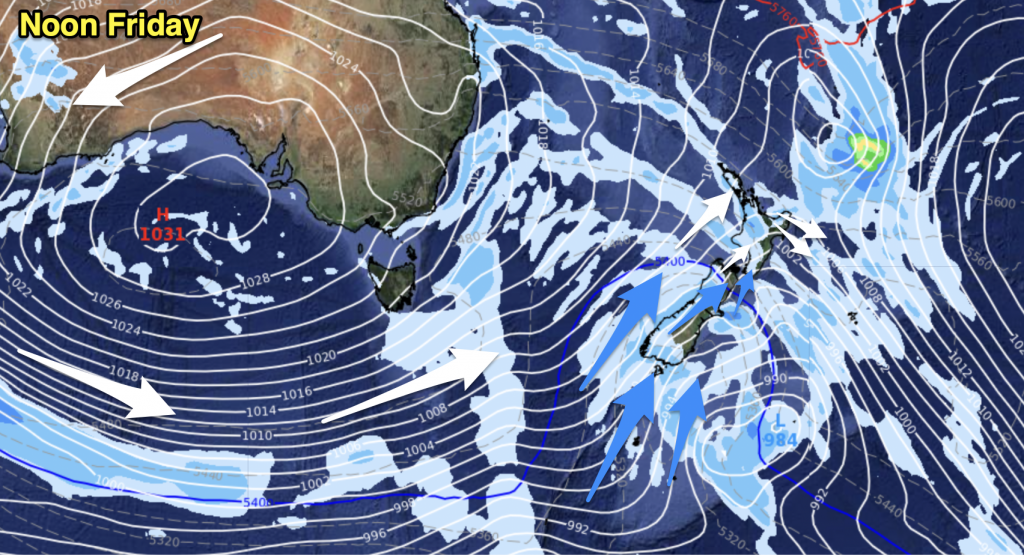
A front sweeps southwards over the North Island today, strong northeasterly winds can be expected (mainly over the upper North Island). Also some heavy rain, mainly about northeastern parts. The South Island is cloudy in the north and east, mostly sunny about Southland and Otago. The West Coast sees sunny areas and high cloud thickening from the north.
Northland, Auckland, Waikato & Bay Of Plenty
Cloudy with rain about Northland spreading southwards, reaching most regions by midday. Rain may be heavy, especially in eastern areas. East to northeasterly winds becoming strong by midday then easing overnight.
Highs: 14-17
Western North Island (including Central North Island)
Mostly cloudy with rain moving into Taranaki and the Central North Island in the evening then further south overnight, rain may be heavy. Easterly winds, becoming strong in the afternoon about Taranaki.
Highs: 12-15
Eastern North Island
Cloudy with drizzle patches from afternoon, then overnight rain with heavy falls at times. Easterly winds pick up by midday.
Highs: 13-15
Wellington
Mostly cloudy, perhaps a few sunny areas at times. Southeasterly winds.
High: 13
Marlborough & Nelson
Mostly cloudy with southeasterly breezes. Some late or overnight patchy showers / drizzle.
Highs: 12-13
Canterbury
Mostly cloudy although afternoon sunny spells are possible. East to northeast winds.
High: 10
West Coast
Sunny areas and some high cloud, thickening during the day. Easterly winds.
Highs: 12-15
Southland & Otago
Mainly sunny with light winds. Frosty morning and night.
Highs: 8-10
By Weather Analyst Aaron Wilkinson – WeatherWatch.co.nz


Add new comment