Storm warning: Thursday’s situation & outlook
12/11/2014 3:49am

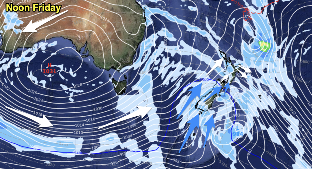
We’ve got our ‘spring blast’ continuing through the latter part of this week, with strong gales, cold air, thunderstorms and hail all on the menu for different parts of the country.
North Island
The cold southwesterly airflow that has brought rough weather for the South Island today continues to lie over the country, and will exert itself fully on the North Island from tomorrow as well.
For Northland and Auckland, it will be wet in the morning – with heavy showers, possible thunderstorms, and even a chance of hail – but conditions will improve from midday, with persistent strong winds from the southwest continuing.
Elsewhere in the North Island, it’s looking like periods of cloud, showers and cool southwesterlies, with showers moving onto the East Coast during the afternoon and evening.
South Island
For the West Coast and Nelson it’s looking like a much improved day, with mostly sunny weather and southwesterly winds. In the ranges behind Nelson it’s looking wetter, especially to the east, with cold isolated showers turning to thunderstorms and possibly hail, too.
For the rest of Marlborough and most of Canterbury, there will be sunny spells with those same southwesterlies, coastal showers and the risk of hail in Canterbury. Isolated showers could pop up about inland parts of North Canterbury through the day, though South and Mid Canterbury are looking better – just a chance of some isolated showers.
And Southland and Otago are looking at showers for much of the day, along with those cold southwesterlies.
For more specifics, check out our latest weather video, here.
– Aaron WIlkinson & Drew Chappell, WeatherWatch.co.nz
– Map: earth.nullschool.net


Add new comment
Guest on 12/11/2014 4:19am
Hey guys, two question, is there a risk ofor hail and or storms in Napier tomorrow, also in your forecasts you say westerly gales in showers, shouldn’t that be squally showers? Thanks
Reply
WW Forecast Team on 12/11/2014 7:51am
Hi there, yes we do have some risk for hail tomorrow in Napier – overnight/ThursAM most likely. It will be isolated – but a few heavy downpours/hail storms are likely. As for squally – yes you’re correct, but you’d be surprised how many people don’t understand the word these days, especially younger people (the word is fairly dated too). We’re all about communicating the weather extremes to as many people as possible, so sometimes we drop the ‘text book’ word in favour for explaining what a squall really is – a heavy shower with a blast of strong to gale force winds.
Cheers 🙂
Philip D
Reply
Guest on 12/11/2014 9:24am
Thanks, im only 15 and interestex un becoming a meteorologist how do i do so, what subjects should i be taking? Thanks
Reply
WW Forecast Team on 12/11/2014 9:37am
Hey there – send us an email using the Contact button at the top of the page and we’ll give you the info on various ways you can get into the weather industry 🙂
Cheers!
– WW
Reply