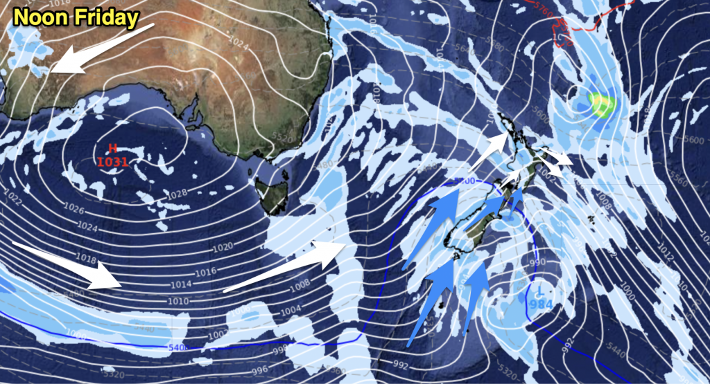
A strong northwesterly airflow lies over New Zealand today, a cold front moves northwards over the South Island during the day reaching the lower North Island in the evening.
Northland, Auckland, Waikato & Bay Of Plenty
Thickening cloud, a shower or two possible from afternoon although big dry areas are still likely. Northwesterly winds.
Highs: 14-17
Western North Island (including Central North Island)
Mostly cloudy with a patchy shower or two at times, later in the evening and overnight rain moves into Taranaki and Kapiti. Breezy northwesterly winds.
Highs: 12-15
Eastern North Island
Mostly sunny with increasing high cloud, a few spots of rain may spread into the Wairarapa at times from late afternoon. Northwesterly winds, gusty about the Wairarapa.
Highs: 14-16
Wellington
Patchy rain (more so from late morning) with strong northwesterly winds, possibly gusting to gale at times.
High: 14
Marlborough & Nelson
Thick high cloud, patchy showers or some rain at times about Nelson and the Sounds from midday. Rain becoming more persistent in the evening with areas of precipitation spreading to the Marlborough coastline also. Brisk to strong northwesterly winds.
Highs: 14-16
Canterbury
Morning spots of rain then a mostly sunny afternoon as gusty northerlies (strong to gale about inland areas) change a more moderate northwest.
Highs: 18-20
West Coast
Morning rain with heavy falls and thunderstorms, easing to showers in the afternoon as gusty northerlies change lighter westerly.
Highs: 12-14
Southland & Otago
Morning rain then becoming sunny as northerlies tend northwest around midday, a warm afternoon.
Highs: 12-16
By Weather Analyst Aaron Wilkinson – WeatherWatch.co.nz


Add new comment