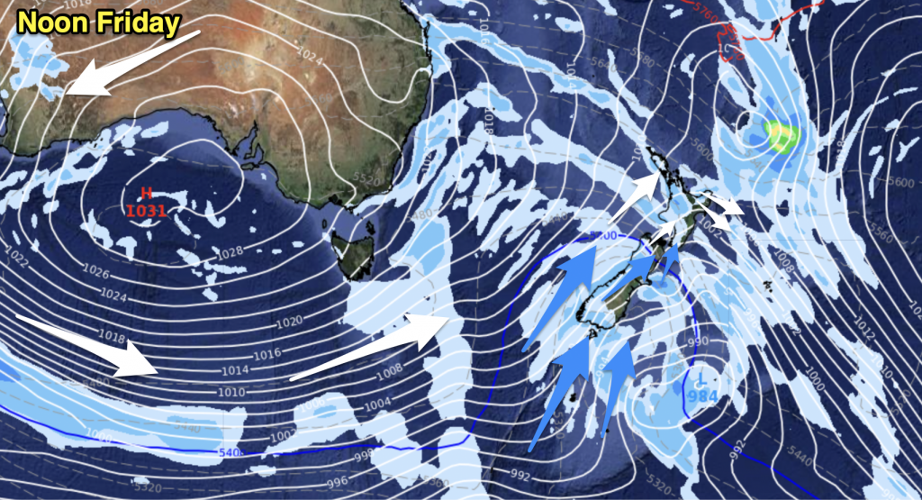
A ridge lies over Auckland and Northland today meanwhile a westerly airflow dominates elsewhere. Generally speaking cloudy skies in the west today and sunny out east with warmer weather.
Northland, Auckland, Waikato & Bay Of Plenty
Cloudy areas break to some sun this afternoon, west to southwesterly winds. Mostly sunny for the Bay Of Plenty.
Highs: 17-20
Western North Island (including Central North Island)
Fairly cloudy with west to northwesterly winds, some sun possible for inland areas during the afternoon.
Highs: 16-17
Eastern North Island
A mainly sunny day with west to northwesterly winds, an onshore breeze may develop this afternoon for a time about Hawkes Bay.
Highs: 22-23
Wellington
Areas of cloud and some sun, cloud thickens later on. North to northwesterly winds become gusty this afternoon.
High: 15
Marlborough & Nelson
Sunny with northwesterly winds becoming gusty this afternoon, Nelson sees westerly winds this morning tend northerly in the afternoon.
Highs: 20-25
Canterbury
Sunny with light winds this morning then northwesterlies pick up this afternoon, possibly becoming strong for inland areas.
High: 24
West Coast
Mostly cloudy with west to northwesterly winds, patchy drizzle mainly about Fiordland then spreading northwards overnight.
High: 15
Southland & Otago
Mostly sunny with high cloud increasing from this afternoon, northwesterly winds becoming strong after midday especially about Southland and inland Otago. Rain moves in overnight for Southland.
Highs: 17-21
By Weather Analyst Aaron Wilkinson – WeatherWatch.co.nz


Add new comment