Another cold blast coming nationwide bringing snow, hail then a big high (+6 Maps)
4/06/2018 10:45pm

Another week and another cold burst of southerly air is coming although unlike last week the upcoming weekend will have high pressure.
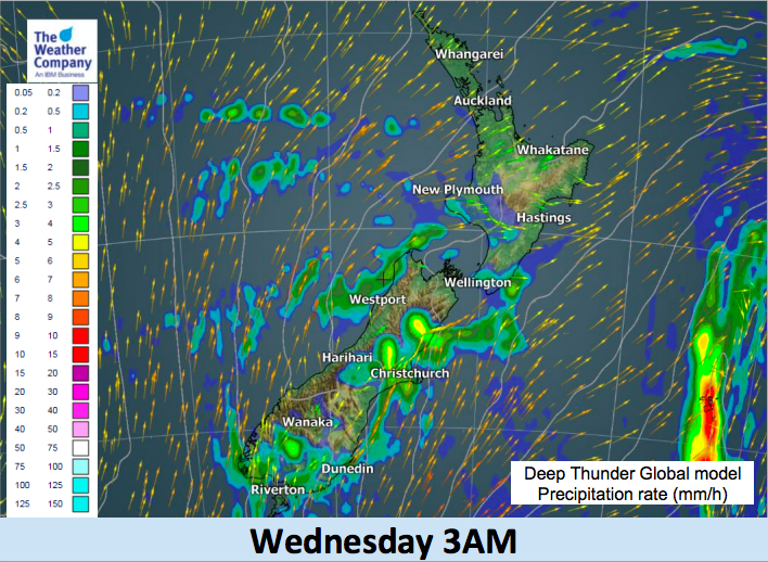
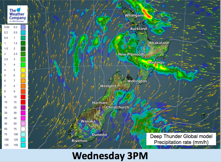
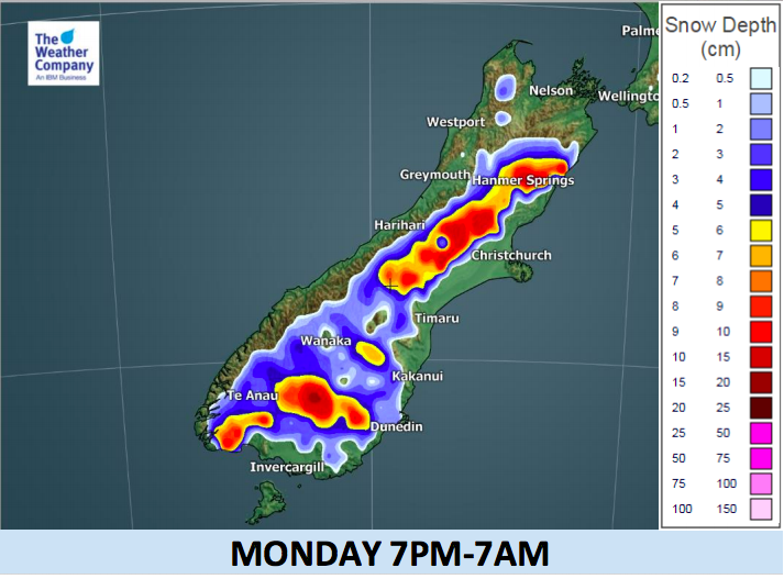
The southerly kicks off in the South Island today and then spreads into the North Island across Wednesday. By the end of Wednesday and across Thursday expect colder than usual weather in most regions. Snow isn’t expected to be too heavy at low levels but flurries to just 100 or 200 metres are possible for a time in some South Island areas over the next 24 to 36 hours (and just like rain showers they can be totally hit and miss). Heavier snow higher up will be more widespread and set in. See our map below for totals.
Later on Wednesday snow may also impact SH5 the Napier to Taupo highways and also SH1 the Desert Road.
Frosty weather moves in towards the end of the week as high pressure builds and locks in the colder air.
However warmer northerlies from the sub-tropics look set to return to New Zealand next week. It appears we’re in a pattern of a cold blast followed by warmer sub-tropical northerlies, indicating New Zealand is unlikely to be colder than average this June overall if the northerly flows continue in the mix. The northerly flows are also the reason we’re seeing so much heavy rain at the moment, especially in the North Island.
As the cold front sweeps northwards over the next day and a half expect heavy downpours and hail in the mix too, reaching as far north as Northland and Auckland by late Wednesday. Canterbury will be one of the coldest regions in New Zealand on Wednesday.


– WeatherWatch.co.nz (An IBM Business Partner)
Comments
Latest Video

VIDEO: Anzac Day + weather to next Tuesday
Anzac Day looks mild for many parts of NZ with windy nor’westers gusting to gale force for some. Many regions…
Related Articles

Friday / Weekend Newsfeed: Windy, showery, Southerly change – but high pressure from Sunday (+4 Maps)
We’ve got ourselves a good ol’ fashioned Autumn sou’west flow with Friday seeing cooler/colder weather spreading across the country with…

Anzac Day Newsfeed: Severe gales, heavy rain for some, settled for others
Updated 4am — High pressure over northern NZ moves east of the country on Thursday while a storm south of…
VIDEO: Anzac Day + weather to next Tuesday
Anzac Day looks mild for many parts of NZ with windy nor’westers gusting to gale force for some. Many regions…


Add new comment