A snowy and wet few days – Your Weekend Weather Highlights
14/07/2016 6:48pm

The weekend looks to start a little more settled, but winds up in a similar vein to the end of the week.
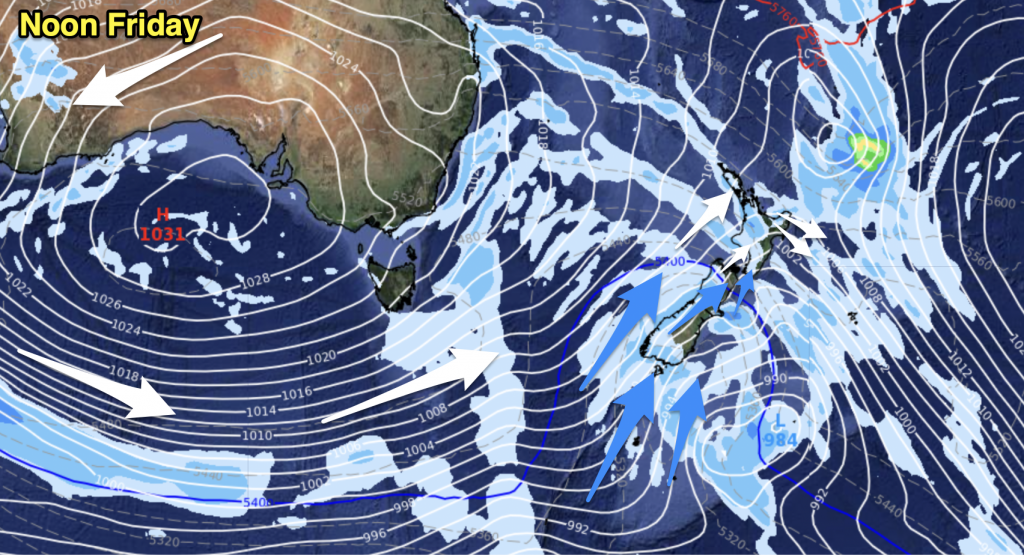
We’re looking at more snow, more rain and more strong winds in many areas as a result of a lingering low pressure system and Antarctic southwest airflow pushing across much of the country.
Friday
Strong to gale northwesterly winds for much of the South Island, especially in the east – and also through Cook Strait.
Winds then ease from the south from morning, as a southwest change moves in – reaching the lower North Island by evening.
South to southwest winds along the Canterbury coast may gust to gale in the afternoon, then late evening too.
As those southerlies reach Wellington, they are likely to be strong to gale.
Strong northwesterly winds gust to gale, and then ramp up over the western North Island during the afternoon, then ease overnight.
The East Coast of the North Island sees gusty northwesterly winds develop in the afternoon, then overnight a strong to gale southwest change pushes northwards along the East Coast.
Mid to late afternoon, rain moves onto the western North Island and may be heavy for a time before easing in the evening.
By early or mid evening there could be heavy showers and possible thunderstorms for Taranaki – and the rest of the western North Island further northwards – later in the evening as a trough moves over.
Rain for the West Coast of the South Island is likely to be heavy with possible thunderstorms, though these ease from afternoon.
Rain that moves into Canterbury during the afternoon may be heavy for a time (mainly inland), before easing by evening as well.
Snow flurries could reach down to around 500m for a time about Southland & Otago, then clear up before midday.
In the evening though, showers return, with snow flurries right down to 600m for a time.
Canterbury should see some snow down to 500m, with any rain clearing in the evening.
Snow is likely about the Central Plateau in the evening and overnight down to 700m.
Any thunderstorms on Friday will carry with them a risk of hail – anywhere in New Zealand.
Saturday
The weekend sees a general calming down of the situation, without too many weather risks – however overnight showers with heavy falls and hail move into Southland, Otago and push northwards along the West Coast of the South Island.
Thunderstorms are possible for coastal Southland and the West Coast of the South Island too, along with these showers.
Sunday
Strong west to southwestely winds about the western North Island from late afternoon.
Strong southwesterlies during the day on Banks Peninsula and some parts of East Coast of the South Island from afternoon.
Strong southerlies about Wellington from late evening.
Showers about Southland and Otago bring snow to 500m for much of the day.
Snow flurries lower to 500m about parts of Canterbury by evening (includes Banks Peninsula which probably gets a bit more snow then other areas due to the SW flow).
The Central Plateau should see snow to 700m from evening.
Late evening and overnight showers from Taranaki northwards in the west – many of which could well be heavy at times with thunderstorms and hail.

– Please note, the idea behind this update is to focus on the main weather highlights, which is why not all regions are mentioned.
For specific 10 day information for your city, town, rural community or island please see the 1000 forecasts on our homepage!
– Aaron Wilkinson & Drew Chappell, WeatherWatch.co.nz


Add new comment